
The Shifting Ground Beneath
At the heart of Nepal's vulnerability is its location on one of the world's most active seismic zones. The entire country sits where the Indian tectonic plate is constantly pushing northwards, colliding with and sliding under the massive Eurasian plate.
This collision, moving at about two inches per year, is the very force that created the Himalayas over millions of years. But this process is not smooth; friction causes stress to build up along massive cracks in the Earth's crust known as fault lines. Major faults like the Main Frontal Thrust and Main Central Thrust run across Nepal. When the accumulated stress is suddenly released, the result is a powerful earthquake, like the devastating 7.8 magnitude Gorkha quake in 2015 that claimed nearly 9,000 lives. The shallow depth of many of these quakes amplifies their destructive power on the surface.
The Double-Edged Sword of the Mountains
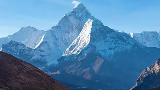
The same tectonic uplift that causes earthquakes also creates Nepal’s iconic, yet treacherous, mountains. The Himalayas are geologically young and steep, making their slopes inherently unstable. This fragility is most evident during the annual monsoon season from June to September, when intense rainfall saturates the ground. The heavy rains frequently trigger devastating landslides that can wipe out entire villages, farmlands, and critical infrastructure like roads and bridges. The risk is compounded by human activities such as unplanned road construction and deforestation, which further weaken the fragile slopes. An earthquake can also act as a trigger, causing thousands of landslides in a cascading effect that isolates already remote communities.
Rivers That Both Give and Take Away
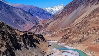
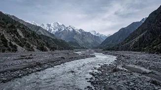
Flowing down from the high Himalayas are more than 6,000 rivers and streams, forming lifelines like the Koshi, Gandaki, and Karnali river systems. These rivers are vital for agriculture, drinking water, and Nepal's growing hydropower sector. However, they also pose a significant threat. During the monsoon, the rivers swell dramatically, causing extensive flooding, particularly in the southern Terai plains. These floods not only damage crops and homes in Nepal but often have cross-border impacts downstream in India. Compounding this issue is the phenomenon of flash floods, where a sudden event upstream—like a landslide blocking a river—can lead to a catastrophic surge of water and debris with little to no warning.
The Growing Threat of Melting Glaciers
A specific and growing danger lurking in the high mountains is the Glacial Lake Outburst Flood, or GLOF. As global temperatures rise, glaciers in the Himalayas are melting at an accelerated rate. This meltwater often collects to form large lakes, dammed only by unstable walls of rock and debris left behind by retreating glaciers. These natural dams can fail suddenly due to pressure from the rising water, an earthquake, or a large avalanche falling into the lake. The result is a GLOF, a sudden and violent flood that rushes down the narrow mountain valleys, destroying everything in its path, including villages and vital hydropower plants. Nepal has identified over 20 potentially dangerous glacial lakes, and the country has experienced more than two dozen GLOF events in recent decades.