

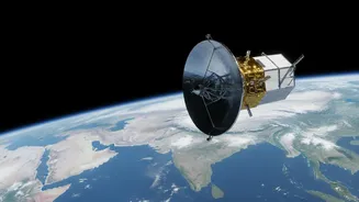
A New Vision for Planet Earth
NISAR is not just another satellite; it's one of the most sophisticated and expensive Earth-imaging satellites ever built, the result of a landmark collaboration between NASA and the Indian Space Research Organisation (ISRO). Launched in July 2025, its
mission is to systematically scan nearly all of Earth's land and ice surfaces every 12 days. What makes NISAR truly special is its ability to see through clouds, darkness, and even dense vegetation, thanks to its advanced radar instruments. This provides a consistent, reliable stream of information about changes in ecosystems, ice sheets, and the ground beneath our feet, helping scientists and policymakers understand everything from volcanic threats to the pace of climate change.
Seeing with Radar, Not Light
Unlike a typical camera that captures visible light, NISAR uses Synthetic Aperture Radar (SAR). Think of it less like taking a photo and more like a bat's echolocation. The satellite sends out a microwave signal (a radar pulse) and then records the 'echo' that bounces back from the Earth's surface. By analyzing these echoes, scientists can build up a detailed picture of the planet's texture, structure, and even subtle movements. NISAR is the first satellite to use two different radar frequencies, L-band and S-band, simultaneously. NASA’s L-band has a longer wavelength, which is excellent for penetrating forest canopies to measure biomass and seeing through soil to detect moisture. ISRO's S-band has a shorter wavelength, providing higher-resolution data ideal for monitoring agricultural crops and the extent of damage after disasters.
The Transformative Power of Open Data
Perhaps the most revolutionary aspect of the NISAR mission is its data policy. All data from the satellite is made freely and openly available to the public, typically within a few days of being collected. In emergencies like earthquakes or floods, this can be fast-tracked to within a few hours. This approach stands in stark contrast to previous models where high-resolution satellite imagery was often proprietary and expensive. The experience with programs like the Landsat satellites showed that making data open sparks an explosion of innovation and economic activity, as the value created by applications far exceeds the cost of the mission itself. By providing this foundational dataset for free, the NISAR mission empowers universities, startups, non-profits, and governments in India and around the world to develop new tools and insights without a prohibitive price tag.
From Pixels to Practical Applications
The real-world applications for this data are vast. For India, NISAR will provide critical information for managing natural resources and hazards. It will allow for precise monitoring of Himalayan glaciers to understand melting rates and water-supply impacts. Farmers can get better soil moisture maps to optimize irrigation and improve crop yields. Planners can track urban sprawl and its effects on infrastructure. In the aftermath of a natural disaster, such as a flood or landslide, NISAR data can quickly generate damage assessment maps, showing emergency responders exactly where help is needed most, even if the area is obscured by clouds. Globally, the data will be a cornerstone for understanding climate change, tracking deforestation, and managing food security.
How to Access the Data Trove
The data is being made available through dedicated online portals. NASA is archiving the L-band data via its Alaska Satellite Facility (ASF), which can be accessed through tools like NASA's Earthdata Search. ISRO is distributing the S-band data through its Bhoonidhi portal. While the raw data is complex, the mission is also developing user-friendly products and tools to help non-specialists explore the information. These platforms are designed to handle enormous datasets, allowing users to analyze the data in the cloud without needing to download terabytes of files to a local computer. Provisional data began rolling out in July 2026, with the full scientific record expected to be available by the end of the year, giving everyone a chance to put this powerful new resource to work.