




The Mountain Time-Dilation Effect
The first rule of Himalayan travel planning is to be skeptical of digital maps. While a mapping app might estimate a 100-kilometre journey to take three hours, the reality on the ground is often double that. This discrepancy isn't a glitch; it's the reality of mountain
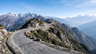
driving. Narrow, winding roads, frequent switchbacks, and surfaces that can vary from smooth tarmac to gravel tracks all drastically reduce average speeds. Add potential delays from local traffic, army convoys, or herds of livestock, and it becomes clear why online estimates are merely a starting point. A more realistic approach is to assume an average speed of 30-40 kilometres per hour and plan accordingly. This automatically builds a more practical timeline for your journey.
The Crucial Role of Seasons
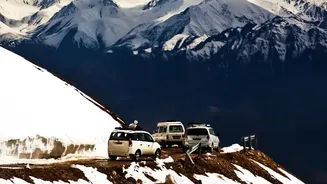
Himalayan road conditions are inextricably linked to the seasons. Your travel time and route accessibility will change dramatically depending on when you go. Spring (March-May) generally offers clear weather, but remnants of winter snow can still block high-altitude passes. The monsoon season (June-August) brings lush green landscapes but also the highest risk of landslides, flash floods, and road blockages, especially in states like Himachal Pradesh and Uttarakhand. Autumn (September-October) is considered a prime season with stable weather, but the window can be short before winter sets in. Winter (November-February) sees many high-altitude routes, like the Manali-Leh highway, close entirely due to heavy snowfall. Always research the specific weather patterns for your chosen region and time of travel.
Not All Routes Are Created Equal
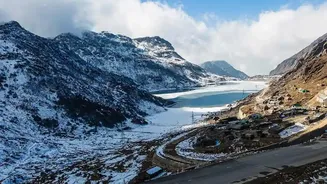
The term 'Himalayas' covers a vast and varied geography. Travel conditions in Ladakh's high-altitude desert are different from those in the forested hills of Sikkim or the rugged terrain of Spiti Valley. For instance, the main Manali-Leh highway is a well-trodden path but involves multiple high passes that require careful acclimatisation and are only open for a few months a year. In contrast, routes around Shimla might be accessible for longer periods but can be prone to heavy tourist traffic. Rain-shadow regions like Ladakh and Spiti are popular during the monsoon because they receive significantly less rainfall, making their roads more reliable during that period. Understanding the specific challenges of your intended route is key to a successful plan.
The Indispensable Buffer Day
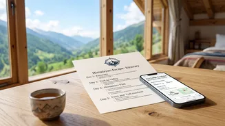
The single most important element to add to any Himalayan itinerary is flexibility, which most often takes the form of buffer days. A buffer day is a day with no planned travel or activities, designed to absorb unforeseen delays. A sudden landslide could close a road for hours, or even days. A patch of black ice might make early morning travel unsafe. Your vehicle could need a minor repair, or you might just feel the effects of altitude and need an extra day to acclimatise properly. Without buffer days, a small delay can have a domino effect, forcing you to rush later parts of your journey or cancel them altogether. For any trip longer than a few days, building in at least one or two buffer days provides peace of mind and turns a potential crisis into a mere inconvenience.
Real-Time Intelligence Gathering
While you can't control the conditions, you can stay informed. Before and during your trip, it's vital to check for the latest road status updates. The Border Roads Organisation (BRO), which maintains many of the strategic highways, often posts updates on its social media channels or official website. Local travel forums, Facebook groups, and even WhatsApp groups for taxi drivers can provide invaluable, on-the-ground intelligence that official sources might miss. When in doubt, talk to the locals—guesthouse owners, drivers, and shopkeepers often have the most current information about the roads you're about to travel. This local network is your most reliable, real-time GPS.