





A New Eye in the Sky
The mission making this possible is NISAR, which stands for NASA-ISRO Synthetic Aperture Radar. It’s a powerful Earth-observing satellite jointly developed by the Indian Space Research Organisation (ISRO) and NASA. Launched in July 2025, it marks a historic
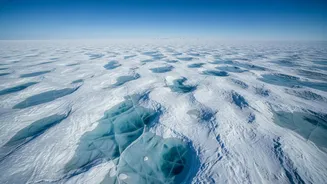
collaboration between the two space agencies. Unlike typical satellites that capture images using optical cameras, NISAR uses a sophisticated radar system. It sends microwave signals towards Earth and analyses the echoes that bounce back. This technology allows it to see through clouds, darkness, and even several feet of snow and ice, making it perfectly suited for studying the harsh and often obscured polar regions.
What Lies Beneath the Ice
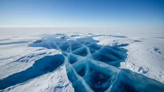
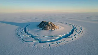
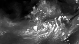
Recent data released from NISAR has provided a breathtaking glimpse into this hidden world. One of the most striking early images shows a feature in East Antarctica that scientists have nicknamed “the hummingbird.” This is not a literal bird, but a pattern formed by deep cracks in the ice, known as crevasses. These crevasses are created as a massive glacier flows towards the ocean and is forced around a rocky mountaintop, or nunatak, that pokes through the ice sheet. The immense pressure fractures the ice in a shape that, from space, uncannily resembles a hummingbird with its wings outstretched. While visually stunning, this formation offers profound scientific insights into how glaciers move and react to obstacles in their path.
The Power of Dual-Frequency Radar
What makes NISAR so revolutionary is that it is the first mission to use two different radar frequencies, L-band and S-band. This dual-view capability provides an unprecedented level of detail. The radar signals return differently based on the surface they hit; for example, smooth ice reflects signals differently than rough, fractured ice. In the hummingbird image, these differences are represented by colours, with magenta showing smooth surfaces and green highlighting the heavily crevassed areas. This allows scientists to distinguish between different ice characteristics and structures that would be completely invisible to a standard optical satellite, which would only see a white, snowy surface. This ability to see what's hidden beneath the surface is a game-changer for glaciology.
Why These Hidden Structures Matter
Observing these hidden ice dynamics is about much more than creating beautiful images. The stability of Antarctica's massive ice sheets is a critical factor in regulating Earth's climate. These ice sheets contain enough frozen water to raise global sea levels significantly if they were to melt. By tracking how glaciers flow, where they are cracking, and how quickly they are moving, scientists can build more accurate models to forecast the future of the ice sheets and, consequently, future sea-level rise. The data from NISAR helps researchers understand the fundamental processes of ice deformation and movement, offering a clearer picture of how these frozen landscapes are responding to a warming climate. This information is vital for coastal communities around the world, including India's extensive coastline.
A Flood of Data for a Changing World
As of late July 2026, the data from NISAR's L-band and S-band radars has been made publicly available to researchers and scientists worldwide. The satellite scans nearly all of Earth's land and ice surfaces every 12 days, producing dozens of terabytes of data daily. This continuous stream of information will not only be used to monitor Antarctica but also to study earthquakes, landslides, forests, and agricultural changes across the globe. For Antarctica, the repeated monitoring will reveal long-term trends in ice behaviour that were previously difficult to identify. This landmark ISRO-NASA mission is set to become one of the most important tools we have for understanding and responding to the changes happening on our home planet.