






India's Eyes in the Sky
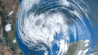
The first step in any modern weather forecast is a view from space. India operates a sophisticated fleet of meteorological satellites, most notably the INSAT series, including INSAT-3D and INSAT-3DR. These geostationary satellites orbit in sync with the Earth,
allowing them to constantly monitor the Indian subcontinent. They are equipped with advanced instruments called imagers and sounders. The imagers capture pictures of cloud patterns, while the sounders measure crucial atmospheric data like temperature, humidity, and water vapour at different altitudes. This provides a continuous stream of information on how weather systems are developing, day and night.
From Satellite Images to Rain Forecasts
Raw satellite data is essentially a collection of images and measurements that need interpretation. Meteorologists at the India Meteorological Department (IMD) analyse these images to identify the characteristics of clouds. The brightness and temperature of a cloud top, for instance, can indicate its height and water content, which helps in estimating its potential to produce rain. By tracking the movement of these cloud systems over time, forecasters can predict their path and determine which areas are likely to receive rainfall. However, satellites primarily see the top of the weather system, which is only part of the story.
Adding Ground-Level Detail with Radar
To achieve greater precision, especially for short-term forecasts, meteorologists turn to Doppler Weather Radars (DWRs). India has significantly expanded its DWR network, which now covers most of the country. Unlike satellites looking from above, radars send out radio waves from the ground to 'see' inside the clouds. When these waves hit raindrops or hailstones, they bounce back, providing information on the precipitation's location, intensity, and movement. The 'Doppler effect'—a change in the frequency of the returning waves—also reveals the speed and direction of the wind within the storm. This is crucial for nowcasting, or predicting rainfall in the next few hours.
The Power of Supercomputers and Models
All this data from satellites, radars, and ground stations is fed into powerful supercomputers. These machines run complex Numerical Weather Prediction (NWP) models. These models are sets of mathematical equations that simulate the physics of the atmosphere and oceans. The IMD uses a variety of models, including the Global Forecast System (GFS), to generate forecasts ranging from a few hours to several days in advance. By processing vast amounts of current weather data, these models predict how atmospheric conditions will evolve, providing detailed forecasts on temperature, wind, and, most importantly, rainfall.
The Unique Challenge of Urban Forecasting
Despite these advanced tools, predicting rainfall with pinpoint accuracy in cities like Mumbai, Chennai, or Bengaluru remains a significant challenge. Urban areas create their own microclimates. The 'urban heat island' effect, where cities are warmer than their surroundings, can alter wind patterns and intensify rainfall in very specific pockets. Buildings can disrupt airflow, and pollution particles can affect how clouds form, sometimes leading to delayed but more intense bursts of rain. This is why one neighbourhood might experience a torrential downpour while another, just a few kilometres away, stays dry. Forecasters are constantly working to refine models to account for these hyper-local effects, but the sheer variability makes it a difficult task.