


A Viral Spectacle from the Hills
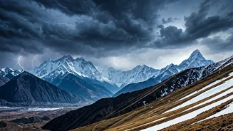
If you've scrolled through social media recently, you've probably seen it. A car winds its way down a mountain road in Himachal Pradesh or Uttarakhand. The sky is clear blue above, but just ahead, the road disappears into a thick, flat-topped, and impossibly
dense layer of white. It looks like a solid wall, a cliff made of cloud. These short, stunning reels, often set to dramatic music, have captivated millions. Captions are filled with words like 'magical', 'surreal', and 'heaven on earth'. Commuters, tourists, and locals alike are pulling out their phones to capture the moment they drive into or above these breathtaking 'cloud walls', turning a daily commute or a holiday drive into a viral event.
What Exactly Is a 'Cloud Wall'?
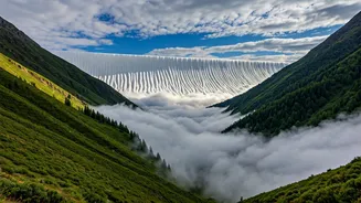
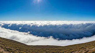
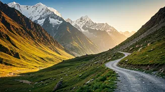
First things first: 'cloud wall' is not a formal meteorological term. It’s a beautifully descriptive name given by onlookers to a very real and fascinating weather event. What people are actually witnessing is a dense formation of valley fog. When viewed from above or from the side, this thick blanket of fog has a sharply defined top, creating the illusion of a solid wall or a 'sea of clouds' filling the valley below. The 'wall' effect is most dramatic when you are descending towards it from a higher elevation, making it seem like you're about to drive off a cliff and into a fluffy white ocean.
The Science Behind the Magic
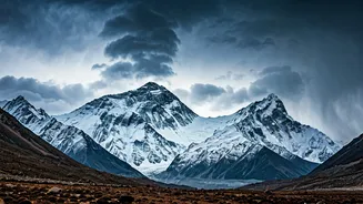
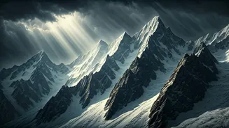
So how does this magical sea of clouds appear? The phenomenon is typically caused by a process called a temperature inversion, which is common in mountainous regions. On a clear, calm night, the ground rapidly loses heat, cooling the air right above it. This cold, dense air then flows down the mountain slopes and settles into the valley floor, like water filling a basin. Meanwhile, a layer of warmer, less dense air remains above it. This acts like a lid, trapping the cool, moist air below. As the trapped air continues to cool overnight, the moisture within it condenses into tiny water droplets, forming a thick, widespread layer of fog. Because this fog is confined to the valley, it creates the stunning, flat-topped appearance seen in the viral videos.
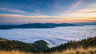
The Perfect Conditions for a Cloud Sea
These cloud walls aren't a year-round occurrence. They are most common during the post-monsoon and winter months, from late October through February. The perfect recipe involves a few key ingredients: recent rainfall or high humidity that provides ample moisture, followed by clear nights that allow for rapid cooling, and calm winds that prevent the cold and warm air layers from mixing. When these conditions align, valleys across the Himalayas can transform into these ethereal cloud-filled landscapes. Popular spots where this is often sighted include the roads around Shimla, Manali, Mussoorie, and Nainital, especially in the early mornings before the sun becomes strong enough to warm the valley floor and dissipate the fog.
More Than Just a Pretty View
While breathtakingly beautiful from above, driving *into* one of these cloud walls is a different experience. The 'wall' is, in reality, extremely dense fog. Visibility can drop to near zero in an instant, making driving conditions treacherous. For local commuters, it's a familiar hazard that demands caution and slower speeds. This duality is part of what makes the phenomenon so compelling—it's a perfect intersection of sublime natural beauty and raw, elemental power. The viral reels capture the awe, but they also serve as a reminder of the dynamic and sometimes dangerous weather that defines life in the mountains.