






A Landmark Collaboration in the Sky
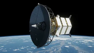
The joint NASA-ISRO Synthetic Aperture Radar, or NISAR, mission represents a monumental collaboration between the two space agencies. This sophisticated satellite, now orbiting 747 kilometres above Earth, is the first of its kind, equipped with two different
radar frequencies, L-band and S-band. This unique combination allows it to scan the planet with remarkable detail, generating a complete picture of Earth’s land and ice every 12 days. While its applications are vast, from tracking glacial melt to monitoring agricultural health, its potential impact on disaster management in India is truly transformative. ISRO, which already has a robust Disaster Management Support Programme, gains a powerful new tool in its arsenal to protect lives and property.
The All-Seeing Radar Eye
Unlike standard optical satellites that are essentially cameras in space, NISAR uses advanced radar technology. This is a game-changer for a country like India, where monsoons mean persistent cloud cover. Radar signals can penetrate through clouds, rain, and even the dark of night, ensuring a constant, reliable stream of data when it is needed most. Think of it as having a superpower to see the ground, unimpeded by weather. This all-weather capability means that disaster management teams are no longer flying blind during a cyclonic storm or heavy downpour. The satellite sends out microwave signals and reads the echoes that bounce back, creating detailed maps of the Earth’s surface, a technique that is exceptionally good at spotting water.
From Raw Data to a Clear Picture
So how does this translate into a usable flood map? The principle is surprisingly elegant. In a radar image, calm, open water acts like a mirror, reflecting the signal away from the satellite, which makes it appear very dark. Land, on the other hand, is rougher and scatters the signal back, appearing brighter. The contrast makes it easy to delineate the precise edge of a flood. Even more impressively, NISAR’s L-band radar can detect flooding beneath forest canopies. When water stands between tree trunks, it creates a “double bounce” effect where the radar signal hits the water and then the trunk before returning to the satellite, creating an unusually bright signature. This allows authorities to see the true extent of inundation, even in heavily vegetated areas that would otherwise be hidden.
Revolutionising Flood Response
This technology moves India from a reactive to a proactive stance on flood management. With data available within hours of a satellite pass, emergency responders can get a near real-time picture of a disaster as it unfolds. This helps them identify the worst-hit areas, plan evacuation routes, and allocate resources like boats, shelters, and medical aid far more effectively. Instead of relying on patchy ground reports, they have a comprehensive map. The satellite essentially acts as a network of virtual stream gauges, measuring changes in water levels across entire river basins. This information is critical for providing downstream communities with advance warning, giving them precious time to prepare for rising waters.
Building Long-Term Resilience
Beyond immediate disaster response, the wealth of data from NISAR will be invaluable for long-term planning. By creating detailed histories of flood patterns, urban planners and policymakers can make more informed decisions about infrastructure development. It can guide where to build homes, roads, and bridges to be less vulnerable to future events. The data can also highlight areas where river embankments need strengthening or where natural floodplains should be preserved. As of July 2026, ISRO has begun releasing NISAR's S-band data to the public through its Bhoonidhi portal, empowering researchers, state governments, and even private citizens to contribute to building a more flood-resilient India.