


An All-Weather Eye in the Sky
Imagine a satellite that doesn’t need sunlight to see and can peer directly through thick clouds and heavy rain. That’s the magic of Synthetic Aperture Radar, or SAR. Unlike traditional optical satellites that work like a camera and are useless on a cloudy
day, SAR is an active system. It sends out its own microwave pulses and reads the signals that bounce back. Different surfaces—like water, dry soil, or dense vegetation—reflect these signals differently. This allows SAR to create detailed, high-resolution images of the Earth’s surface day or night, in any weather. This all-weather, 24/7 capability makes it an incredibly reliable tool for observing our planet.
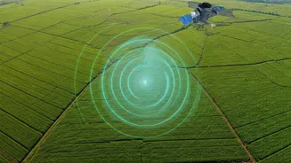
Revolutionising Indian Agriculture
For a nation where agriculture is the backbone of the economy, SAR technology is a game-changer. One of its key applications is measuring soil moisture with remarkable precision. By understanding exactly which parts of a field are dry or waterlogged, farmers can optimise irrigation, saving water and improving crop health. SAR data can also differentiate between various crop types, monitor their growth stages, and estimate the total biomass, which helps in predicting yields. This information is invaluable not just for individual farmers but for national food security planning. India's own RISAT series of satellites already leverage SAR for these purposes, and this data is integrated into schemes like the Pradhan Mantri Fasal Bima Yojana for better crop insurance assessment.
A Lifeline in Times of Crisis
When natural disasters strike, the first few hours are critical. This is where SAR’s ability to see through clouds and darkness becomes a life-saving asset. During major floods, when the affected region is often covered by storm clouds, SAR satellites can precisely map the extent of the inundation, showing relief agencies exactly where to send help. After an earthquake, it can detect subtle changes in the ground surface, as small as a few millimetres, to assess damage to infrastructure like roads and bridges, even in areas that are physically inaccessible. This rapid, accurate damage assessment allows for a much faster and more effective emergency response, helping to save lives and direct resources where they are needed most.
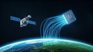
The 'Learning' in SAR Learning
SAR satellites generate an enormous amount of data—far too much for humans to analyse manually in a timely manner. This is where the “learning” part comes in. By applying machine learning and artificial intelligence (AI) algorithms, we can teach computers to automatically interpret SAR images. These algorithms can be trained to identify patterns, classify different land covers, and detect changes over time. For instance, an AI model can instantly differentiate between a healthy crop and a stressed one, or automatically flag a newly flooded area. This automation not only accelerates the analysis from days to minutes but also increases its accuracy, providing actionable insights almost in real-time.
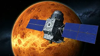
India's Future with NISAR
The future of SAR technology in India looks exceptionally bright, largely thanks to the upcoming NISAR (NASA-ISRO Synthetic Aperture Radar) mission. This joint project between the US and Indian space agencies is the world's first dual-frequency SAR satellite and is set to be a revolutionary tool. NISAR will scan nearly the entire planet every 12 days, providing an unprecedented stream of high-resolution, consistent data. Its two different radar frequencies will provide comprehensive information, from soil moisture deep beneath forest canopies to the health of surface crops. For India, NISAR will be a monumental leap forward, enhancing our ability to manage agricultural resources, monitor climate change impacts, and drastically improve disaster preparedness and response across the nation. Recent partnerships, such as between ICEYE and Agnikul Cosmos, also signal a growing private sector ecosystem for building and launching SAR systems from India, promising even greater sovereign capabilities.