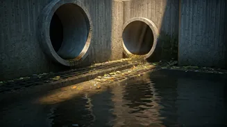


The Challenge of Localised Flooding
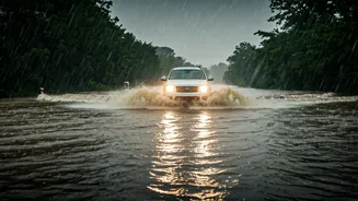
Every year, Indian cities grapple with monsoon flooding. While official weather reports from agencies like the India Meteorological Department (IMD) are excellent for predicting large-scale rainfall, they can’t pinpoint which specific street or underpass
will be submerged. A heavy downpour in one part of the city might leave another completely dry. This is the problem of 'hyper-local' weather events. A traditional forecast might tell you to expect rain, but it won’t tell you that the service lane near your office is already two feet under water. This unpredictability is what makes navigating during the rains so stressful and dangerous, often leading to stalled vehicles, massive traffic jams, and significant delays.
The Power of the Crowd
This is where crowd-sourced weather and traffic software comes in. Instead of relying solely on meteorological data, these applications harness the power of their users. Think of it as a digital neighbourhood watch for roads. When a driver encounters a flooded street, a fallen tree, or a major pothole, they can report it directly within the app. This information is then instantly shared with all other users in the area. The more people who use and contribute to the app, the more accurate and up-to-date the information becomes. It transforms every user from a passive commuter into an active data point, creating a real-time, dynamic map of road conditions that is far more granular and immediate than any traditional forecast could ever be.
Your Go-To App: Google Maps
For most smartphone users in India, Google Maps is already the default navigation tool. Over the years, it has integrated powerful crowd-sourcing features, partly thanks to its acquisition of Waze. When you are navigating, Google Maps will often automatically reroute you around severe traffic jams, which are frequently caused by waterlogging. More importantly, it allows users to report incidents. By tapping the 'report' button (a speech bubble with a plus sign), you can flag hazards like flooding, crashes, or road closures. When other users do the same, these locations appear on the map with a warning icon, giving you a chance to choose an alternative route before you get stuck. The app’s massive user base in India ensures that these reports are frequent and cover a wide area, making it an indispensable tool during the monsoon.
A Strong Alternative: Waze
While Google Maps has integrated crowd-sourcing, Waze is the app that was built on it from the ground up. Waze’s entire platform is based on a community of drivers sharing real-time information. Its user interface is designed to make reporting incredibly simple. You can report everything from police presence and speed traps to road hazards, including flooding, with just a few taps. Waze users are often highly engaged, providing a constant stream of updates on road conditions. If a road is reported as flooded by multiple users, Waze will actively guide other drivers away from it. Its playful interface and community-focused features make it a favourite for many daily commuters who want the most current information possible.
Tips for Effective and Safe Use
To make the most of these apps, a little strategy helps. First, always check your route on the app *before* you leave, not after you’ve already started driving. This gives you a chance to see reported hazards in advance. Second, keep an eye out for automatic rerouting suggestions; they are often the first sign of a major problem ahead. Third, if you encounter a flooded road that hasn’t been reported, contribute! But do so only when it is safe—pull over or have a passenger make the report. Never use your phone while driving. Finally, remember that these apps are guides, not gospel. If a road looks dangerously flooded to your eyes, do not attempt to cross it, even if the app suggests it's clear. Your judgment on the ground is your most important safety tool.