







A Constant Watch from a Fixed Perch
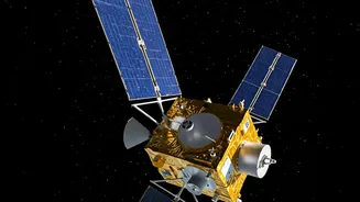
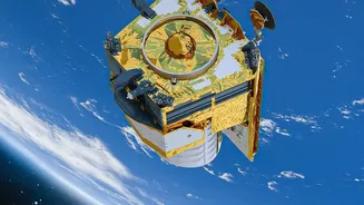
Most Earth observation satellites are in a Low Earth Orbit (LEO), circling the planet several times a day. They provide excellent detail but can only see a specific location for a few minutes at a time. GISAT-1A is different. It is destined for a geostationary
orbit, a high-altitude perch where it will match the Earth's rotation. From the ground, it will appear to hang motionless in the sky, fixed over the Indian subcontinent like a celestial watchtower. This unique vantage point is the key to its power, enabling continuous monitoring of a vast area, a capability India has been striving to achieve. The original mission, GISAT-1 (also known as EOS-03), was lost during a launch failure in August 2021 due to an issue with the GSLV rocket's cryogenic stage. GISAT-1A, its successor, is a high-stakes mission aiming to finally place this crucial asset in orbit.
A Game-Changer for Disaster Management
For a country prone to natural calamities, the ability to monitor developing situations in near real-time is invaluable. Disasters like cyclones, floods, and forest fires evolve rapidly, often in a matter of hours. A satellite that flies by only once or twice a day can miss critical changes. GISAT-1A is designed to image the entire Indian landmass every half hour and can be directed to focus on a specific area of interest, capturing images every five minutes. This persistent stare will allow authorities to track a cyclone's path with greater accuracy, monitor floodwater levels as they rise, and detect forest fires almost as soon as they start. This high-frequency imaging provides a crucial advantage, enabling faster, more effective responses that can save lives and property.
Strengthening National Security
Beyond its civilian applications, GISAT-1A holds significant strategic importance. The ability to maintain a constant watch over India's borders and surrounding maritime regions offers a powerful tool for national security. While other satellites provide high-resolution imagery, their predictable orbits can be tracked. A geostationary imaging satellite provides a persistent surveillance capability that is much harder to evade. It can monitor troop movements, infrastructure development, and naval activity in areas of interest without the long gaps between passes that are typical of LEO satellites. This constant vigilance strengthens India’s strategic awareness and provides timely intelligence for its defence forces.
Powering Agriculture and Climate Science
The satellite's advanced instruments, including multi-spectral and hyperspectral imagers, will offer rich data for a wide range of scientific and economic activities. For agriculture, this means better monitoring of crop health, soil moisture, and the impact of droughts across large regions. This data can lead to more accurate yield predictions and better resource management. For climate scientists, GISAT-1A will provide a continuous stream of information on crucial environmental indicators. This includes tracking the melting of Himalayan glaciers, monitoring changes in coastlines, and assessing the health of forests and other vital ecosystems. By providing a long-term, uninterrupted dataset, the satellite will become an essential tool in understanding and mitigating the effects of climate change in the subcontinent.
A Test of Resilience for ISRO
The upcoming launch of GISAT-1A aboard the GSLV-F17 rocket is more than just a single mission; it is a testament to the Indian Space Research Organisation's resilience. The launch, scheduled for early September 2026, comes after a challenging period for ISRO, which included the 2021 GISAT-1 failure and subsequent setbacks with its reliable PSLV rocket in 2025 and 2026. This mission is ISRO's return to flight after a seven-month pause to rectify technical issues. A successful launch will not only deliver a game-changing satellite but also restore confidence in ISRO's launch capabilities and mark a triumphant comeback, proving that past failures have paved the way for future success.