






A Delicate Dance in the Cosmos
After its successful launch aboard the GSLV-F17 rocket, the EOS-05 satellite was placed into a highly elliptical sub-geosynchronous transfer orbit. This initial path had a low point (perigee) relatively close to Earth and a high point (apogee) much farther
out. The mission for ISRO's scientists at the Master Control Facility was to transform this ellipse into a stable, circular geosynchronous orbit. This was achieved through three precisely calculated firings of the satellite's onboard Liquid Apogee Motor (LAM). Each burn, performed at the perigee, acted like a powerful push, increasing the satellite's velocity and raising the lowest part of its orbit. This delicate cosmic dance, conducted over several days from tens of thousands of kilometres away, has nudged the 2,367 kg satellite progressively higher, preparing it for its vital mission.
India's Watchful Guardian
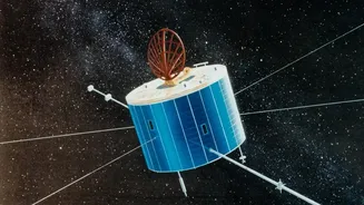
So, what exactly is EOS-05? Dubbed an “Eye in the Sky,” it is India’s first dedicated imaging satellite designed to operate from a geosynchronous orbit, roughly 36,000 kilometres high. Unlike satellites in Low Earth Orbit (LEO) that pass over a location for only a few minutes each day, a satellite in a geosynchronous orbit matches the Earth's rotation. This allows EOS-05 to remain seemingly stationary over the Indian subcontinent, providing a persistent, unblinking view. It is equipped with state-of-the-art imaging instruments, including multispectral and hyperspectral sensors. This means it can see far beyond the visible spectrum, capturing detailed information about everything from vegetation health to atmospheric aerosols. Reports suggest it carries one of the highest-resolution cameras ever placed in such a high orbit, capable of imaging a selected area every five minutes and the entire Indian landmass every 30 minutes.
From Security to Disaster Relief
The applications for this kind of persistent surveillance are vast and transformative for India. On the strategic front, EOS-05 provides an unprecedented capability to monitor the nation’s borders and vast maritime zones in near real-time, offering a crucial advantage in national security. For disaster management, the satellite is a game-changer. It can continuously track the development of cyclones in the Bay of Bengal, monitor the rapid progression of floods and forest fires, and even provide early warnings for events like glacial lake outbursts in the Himalayas. This constant stream of data dramatically reduces reaction times for emergency services. Beyond security and safety, the satellite will also be a vital tool for economic and environmental management, providing invaluable data for agricultural planning, monitoring crop health, tracking urbanisation, and studying the effects of climate change.
The Geostationary Advantage
The final destination for EOS-05 is what makes it so special. Most Earth observation satellites, like those in the Cartosat and RISAT series, operate in LEO, just a few hundred kilometres up. This proximity allows for very high-resolution images, but it comes with a major trade-off: they only see a specific location for brief moments during their orbit. EOS-05's position in a high-altitude geosynchronous orbit sacrifices some of that extreme close-up detail for the invaluable asset of persistence. By hovering over one region, it eliminates the long blind spots between passes that are inherent to LEO satellites. This 'always-on' capability is what enables the continuous monitoring of rapidly evolving events, something that a fleet of LEO satellites would struggle to replicate. It represents a significant strategic enhancement to India's space-based assets, plugging a long-standing gap in its observation capabilities.