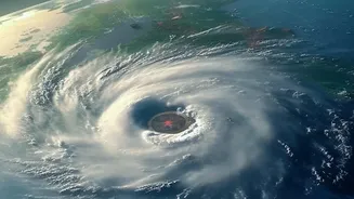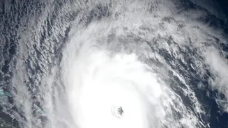








A cyclonic storm named 'Akvan' has formed in the Bay of Bengal, prompting the India Meteorological Department (IMD) to issue an alert for the Andhra Pradesh coast. The system is intensifying and heading towards a stretch from Nellore to Tuni.
The Latest on Cyclone Akvan
The India
Meteorological Department (IMD) has confirmed that a deep depression in the Bay of Bengal intensified into a cyclonic storm named 'Akvan' on the evening of November 16. The name 'Akvan' was contributed by Iran to the regional list of cyclone names. As of the latest reports, the storm is moving in a north-northwesterly direction and is expected to strengthen significantly over the next 48 hours. The IMD is tracking its path closely, providing regular updates to state authorities and the public. This system is the third major storm to form in the Bay of Bengal in recent weeks, following Cyclones Arnab and Murasu, making it an unusually active post-monsoon season.
IMD's Official Forecast and Intensity
According to the IMD's forecast, Cyclone Akvan is projected to intensify into a Severe Cyclonic Storm by November 17 and further into a Very Severe Cyclonic Storm by the morning of November 19. The storm is expected to make landfall around noon on Friday, November 20. At the time of crossing the coast, it is predicted to have maximum sustained wind speeds of 120-130 kmph, with gusts reaching up to 145 kmph. The IMD has issued an 'Orange Message' for the Andhra Pradesh and adjoining south Odisha coasts, which signifies a cyclone alert and calls for preparedness.
Focus Area: Nellore to Tuni
The entire coastal belt of Andhra Pradesh from Nellore in the south to Tuni in the north is under watch as the cyclone's predicted landfall area. This puts several districts, including SPSR Nellore, Prakasam, Bapatla, Krishna, West Godavari, Konaseema, Kakinada, and Visakhapatnam, at high risk. The IMD warns of extremely heavy rainfall (over 20 cm) in isolated places across coastal Andhra Pradesh on November 19 and 20. A storm surge of 1 to 2 metres above the normal tide is also expected, which could inundate low-lying areas during landfall. The maximum impact is anticipated from Thursday night to Friday afternoon.
What Residents Should Do
The IMD and state authorities have issued specific advisories for people in the threatened regions. Fishermen have been strictly warned not to venture into the sea until November 21, and those already at sea have been advised to return to the coast immediately. Residents in low-lying and coastal areas are urged to move to safer locations or designated cyclone shelters. It is crucial to secure your home, prepare an emergency kit with essentials like food, water, and first aid, and keep mobile phones charged. Authorities have also warned against spreading or believing misinformation on social media and to rely only on official IMD bulletins.
Government and NDRF Preparedness
The Andhra Pradesh government has put the coastal districts on high alert. The Chief Minister has reviewed the state's preparedness with the Real Time Governance Society (RTGS) to coordinate response efforts. National Disaster Response Force (NDRF) and State Disaster Response Force (SDRF) teams have been deployed to vulnerable districts for emergency rescue and relief operations. Medical teams, emergency beds, and essential supplies like drinking water and rations are being kept ready. Officials are also monitoring water levels in reservoirs to manage potential inflows from heavy rains.