





India’s Watchful Guardian in Orbit
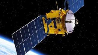
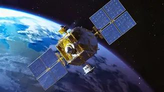
Launched by the Indian Space Research Organisation (ISRO) in November 2022, EOS-06 is a third-generation satellite dedicated to oceanography and atmospheric studies. It circles the Earth in a polar orbit at an altitude of about 740 kilometres, ensuring
it can observe the entire globe. Its primary mission is to provide continuous data for a variety of applications, from predicting cyclones to identifying potential fishing zones, effectively serving as a sentinel for India’s vast maritime interests and coastal populations. The satellite is designed to continue and improve upon the services of its predecessors, Oceansat-1 and Oceansat-2, enhancing India's capabilities in remote sensing.
The Technology Behind the Vision
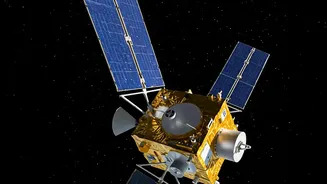
To achieve its goals, EOS-06 carries a suite of advanced instruments. The main payloads are the Ocean Colour Monitor (OCM-3), a Ku-Band Scatterometer (SCAT-3), and a Sea Surface Temperature Monitor (SSTM). Think of these as the satellite's specialised eyes. The OCM-3 is a sophisticated camera that observes the ocean in 13 different spectral bands. This allows it to measure the concentration of phytoplankton—microscopic marine algae—which forms the base of the marine food web. The SSTM, as the name suggests, measures the temperature of the ocean's surface, a critical factor in the formation and intensification of cyclones. Unfortunately, the SSTM encountered a technical issue and is not currently operational, but the other instruments provide a wealth of data.
Tracking Cyclones with Precision
The real game-changer for weather forecasting is the scatterometer, SCAT-3. This instrument is a type of radar that sends microwave pulses towards the ocean and measures the signals that bounce back. The roughness of the ocean surface affects this backscatter, which allows scientists to calculate both wind speed and, crucially, wind direction over the water. This ability to determine wind vectors is what makes scatterometers unique and indispensable for tracking the formation and movement of cyclones. By providing detailed, high-resolution wind data, OSCAT-3 gives agencies like the National Centre for Medium Range Weather Forecasting (NCMRWF) the vital information needed to issue timely and accurate cyclone alerts, helping save lives and protect property along India's coasts.
From Raw Data to Actionable Insights
The data beamed down from EOS-06 is just the beginning. This raw information is processed and analysed by institutions like the Indian National Centre for Ocean Information Services (INCOIS) in Hyderabad. Here, the data on ocean colour, temperature, and wind is transformed into practical, value-added products. For example, OCM data on phytoplankton blooms helps identify Potential Fishing Zones (PFZs), which are shared with fishing communities to help them improve their catch efficiently and safely. Similarly, wind and temperature data are fed into numerical weather prediction models to improve the accuracy of forecasts for everything from the daily weather to the onset of the monsoon.
More Than Just Weather
While its role in weather monitoring is paramount, the applications of EOS-06 extend much further. The satellite's data supports a wide range of scientific research and operational needs. It helps in monitoring sediment dynamics in coastal areas, provides alerts for harmful algal blooms, and assists in climate change studies by measuring ocean carbon uptake. The OCM-3 instrument also measures vegetation greenness on land, contributing to our understanding of the global biosphere. By providing simultaneous data on winds, ocean biology, and land vegetation, EOS-06 offers a uniquely holistic view of our planet's interconnected systems, solidifying its status as a critical asset for India's scientific and economic progress.