





Beyond City-Centric Forecasts
Traditionally, weather forecasts are tied to a specific city or district. While helpful, they don't capture the changing conditions one might encounter on a long drive between two points. A sunny start in Delhi doesn't guarantee a clear drive through
Haryana and Punjab, especially during monsoon or winter fog. The IMD's Highway Forecast service is designed to solve this problem. It provides weather information specifically for major national highways, allowing travellers to see a detailed forecast for the entire stretch of their road journey. This moves beyond a simple destination-based model to a more dynamic, route-based system that reflects the reality of travel.
What Information Can You Expect?
The route forecast tool offers more than just a rain prediction. Travellers can access detailed, sector-based information on temperature, humidity, wind speed and direction, and rainfall for the road ahead. Crucially, it also includes specific warnings for extreme weather phenomena. This can range from heavy rainfall, thunderstorms, and dust storms to fog, heat waves, and cold waves that could impact driving conditions and safety. By providing warnings for hazards like landslides in vulnerable hilly areas or reduced visibility due to fog, the service helps drivers prepare for or even avoid dangerous situations.
How to Access the Highway Forecasts
The IMD makes this information accessible through its official website, Mausam. On the site, users can navigate to the 'Highway Forecast' section, which is listed under specialised forecasts. The portal provides forecasts for major routes, including corridors like the North-South and East-West corridors and the Golden Quadrilateral. Regional meteorological centres also provide highway forecasts relevant to their specific states, such as for routes in Gujarat, Maharashtra, and North West India. The service is also integrated into other platforms like the UMANG app, which consolidates various government services. This makes it easier for travellers to get reliable data directly from the source.
A Tool for Year-Round Planning
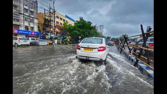
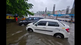
While the immediate benefit during the monsoon season is obvious—helping to avoid waterlogged roads and flash floods—the utility of route forecasts extends throughout the year. In the winter months, dense fog in Northern India is a major cause of highway accidents; a route-specific forecast can warn drivers of poor visibility patches. During summer, extreme heat waves can make travel uncomfortable and even dangerous, and warnings can help in planning travel for cooler parts of the day. The service also benefits the transport and logistics industry, where delays due to weather can have significant economic consequences. For tourists, especially those heading to hill stations like in Uttarakhand and Himachal Pradesh, warnings about rain and thunderstorms are critical for a safe journey.
The Technology Driving Safer Travel
This enhanced forecasting capability is powered by significant technological upgrades at the IMD. The department uses a combination of Doppler Weather Radars, automatic weather stations, and advanced geographical information system (GIS) technology to provide real-time, interactive updates. High-resolution weather models running on powerful supercomputers allow for more precise and localised predictions. By integrating data from satellites, radars, and ground observatories, the IMD can create a dynamic and detailed picture of weather conditions as they evolve along India's vast road network, a major step forward in ensuring traveller safety and convenience.