







India’s Eyes in the Sky
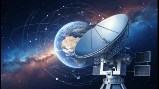
The magic behind modern weather forecasting in India lies thousands of kilometres above our heads in geostationary orbit. This is the domain of the Indian Space Research Organisation’s (ISRO) advanced meteorological satellites, primarily from the INSAT
series. Satellites like INSAT-3D, INSAT-3DR, and the newer INSAT-3DS are the unsung heroes of your daily weather report. These are not just simple cameras; they are sophisticated observatories in space. Equipped with powerful imagers and sounders, they constantly monitor the Indian subcontinent and the surrounding oceans. The imagers capture pictures of cloud patterns, while the sounders measure crucial atmospheric data like temperature, humidity, and water vapour at different altitudes. This allows them to create a three-dimensional picture of the atmosphere, which is essential for accurate forecasting.
From Orbit to Your App
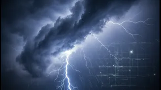
So how does a picture of a cloud from space end up as a rain alert on your phone? The process is a marvel of collaboration. The INSAT satellites capture raw data and beam it down to ground stations. This data is then relayed to the India Meteorological Department (IMD). At the IMD, scientists and meteorologists process this wealth of information. They use the satellite imagery to track the formation and movement of clouds, identify developing weather systems like cyclones and thunderstorms, and analyse atmospheric conditions. This satellite data is then integrated with information from ground-based weather stations, weather radars, and complex numerical models to generate forecasts with increasing accuracy. Finally, these forecasts are disseminated to the public through various channels, including television, radio, and dedicated mobile apps like 'Mausam'.
More Than Just an Umbrella Alert
The impact of this satellite technology goes far beyond helping you decide whether to carry an umbrella. The ability to accurately track cyclones has been a game-changer for disaster management in India. Since the inception of the INSAT program, the ability to issue timely and precise warnings for cyclones approaching India's long coastline has saved countless lives. Animated sequences of satellite images allow forecasters to predict a cyclone's track and intensity with much greater confidence. Furthermore, this data is vital for farmers. Agrometeorological services use satellite information to provide advisories on sowing, irrigation, and harvesting, which is crucial for a country so dependent on the monsoon. From aviation to marine navigation, the ripple effects of this space-based infrastructure are felt across numerous sectors.
The Future of Forecasting is Sharper
The conversation about the weather is only going to get more precise. ISRO and the IMD are continuously working to upgrade their capabilities. The launch of INSAT-3DS in early 2024 brought even more advanced imaging and sounding capabilities, which will augment the services provided by its predecessors. These new-generation satellites offer better resolution, meaning they can see smaller features in the atmosphere, and provide data more frequently. There are plans for a fourth generation of INSAT satellites which promise even higher resolution and sensors specifically designed for lightning forecasting. The integration of Artificial Intelligence (AI) and Machine Learning (ML) is also set to revolutionise how this vast amount of satellite data is analysed, promising faster and more localised forecasts, potentially predicting events like cloudbursts with better lead time.