






A Groundbreaking Partnership in Orbit
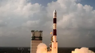
The NASA-ISRO Synthetic Aperture Radar, or NISAR, is more than just a satellite; it's a testament to the powerful scientific partnership between India and the United States. Launched in July 2025, this sophisticated Earth observation satellite is equipped
with advanced radar instruments designed to monitor our planet's surface with incredible detail. Under the partnership, NASA provided the L-band radar, while ISRO contributed the S-band radar and the launch vehicle, making it a truly collaborative mission. NISAR’s primary goal is to map changes on Earth, from the slow crawl of glaciers to the subtle shifts in land before an earthquake. But for India, one of its most immediate and impactful applications is in the fight against floods.
Seeing Through the Monsoon Clouds
A major challenge in monitoring floods during the monsoon is the dense cloud cover that obscures the ground from conventional optical satellites. This is where NISAR's technology becomes a game-changer. Its Synthetic Aperture Radar (SAR) can see through clouds, darkness, and heavy rain, providing an uninterrupted view of the Earth's surface. The satellite uses two different radar frequencies, L-band and S-band. This dual-frequency capability allows it to not only detect the presence of water but also to penetrate through vegetation canopies. This means it can identify waterlogging in forests and croplands, providing a far more accurate picture of the true extent of flooding—something that has been difficult to achieve until now.
From Raw Data to Lifesaving Alerts
NISAR scans the entire globe every 12 days, generating high-resolution images that can detect changes as small as a centimetre. When a flood event occurs, this data is invaluable. As the satellite passes over an affected region like the Brahmaputra basin in Assam, it captures detailed imagery of the inundated areas. This data is then downlinked to ground stations, processed by centres like ISRO's National Remote Sensing Centre, and turned into actionable maps. These maps can clearly delineate the boundaries of the floodwaters, showing exactly which villages, roads, and farmlands are affected. Crucially, this information can be made available to disaster management agencies within hours of the satellite observation, enabling a rapid and targeted response.
Transforming Disaster Management on the Ground
The availability of timely and precise flood maps from NISAR has the potential to fundamentally transform disaster management in India. For disaster response teams, it means knowing exactly where to direct resources, such as rescue boats and relief supplies. It helps in planning safer evacuation routes and setting up temporary shelters in areas confirmed to be on higher ground. Instead of relying on patchy ground reports, authorities can have a comprehensive, near real-time overview of the situation. This capability has already been demonstrated with recent images of the Brahmaputra, helping scientists and disaster managers track erosion and channel shifts. These regular observations offer an unprecedented view that will significantly improve future preparedness and mitigation efforts.
Beyond Floods: A Tool for a Resilient India
While flood management is a critical application, NISAR's capabilities extend to numerous other areas vital for India. The same data can be used to monitor agricultural health, track soil moisture for better crop forecasting, study landslides in the Himalayas, and monitor changes in groundwater levels. It provides crucial information for managing natural resources, understanding the impacts of climate change, and ensuring sustainable development. ISRO has already begun making NISAR's S-band data publicly available through its Bhoonidhi portal, empowering researchers, policymakers, and the public with this powerful new resource. The mission represents a leap forward in using space technology to address Earth's most pressing challenges.