


The Monsoon's Unpredictable Embrace
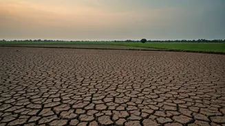
The primary driver of weather in Eastern India, especially in July, is the Southwest Monsoon. This seasonal phenomenon brings much-needed rain but is far from a gentle, steady presence. The India Meteorological Department (IMD) has forecast that while
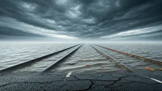
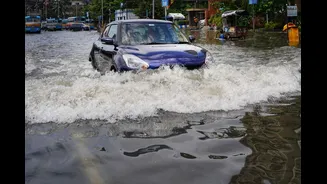
the monsoon has advanced across the region, rainfall in July 2026 might be varied, with some areas potentially seeing normal to above-normal rain while an overall deficit is possible. A key factor is the formation of low-pressure areas over the Bay of Bengal, like the one that developed near the coasts of north Odisha and West Bengal around July 2nd. These systems are crucial for drawing moisture from the sea and can lead to spells of intense, heavy rainfall with little warning, causing waterlogging and disrupting daily life.
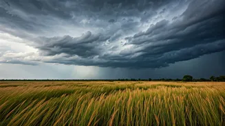
The Fury of the Nor'westers
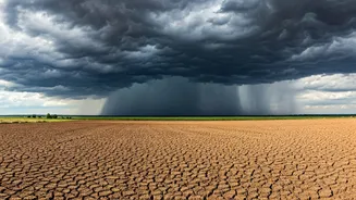
Even within the broader monsoon season, Eastern India is famous for a particularly violent and sudden type of thunderstorm known as Nor'westers, or 'Kalbaishakhi' in Bengali, meaning 'calamity of the month of Baisakh'. These are not ordinary storms. They typically form over the Chota Nagpur Plateau in Jharkhand, where intense daytime heating causes hot, dry air to rise. This air then clashes with warm, moist winds blowing in from the Bay of Bengal. The result is an explosive release of atmospheric instability, creating towering cumulonimbus clouds that can unleash squally winds exceeding 100 km/h, torrential rain, and sometimes hail. These storms often occur in the late afternoon or evening and can turn a calm day into chaos within minutes.
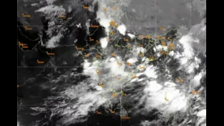
The Bay of Bengal: A Cyclone Nursery
The Bay of Bengal is a notorious breeding ground for tropical cyclones, and its unique characteristics contribute to their rapid formation and intensification. The bay is relatively shallow and semi-enclosed, which allows its surface waters to heat up quickly and stay warm. This high sea surface temperature, often above 28°C, acts as powerful fuel for storms. Furthermore, the shape of the coastline can funnel winds, amplifying a storm's power as it approaches land. Scientists have observed an alarming trend of 'rapid intensification', where a storm can escalate from a cyclonic storm to a super cyclone in less than a day, as seen with Cyclone Amphan in 2020. This happens when a storm taps into deep pockets of warm ocean water, allowing it to strengthen explosively just before making landfall.
A Unique Geographical Cocktail
The volatility of Eastern India's weather stems from a unique confluence of geographical and atmospheric factors. You have the vast, warm expanse of the Bay of Bengal supplying abundant moisture. To the north, the Himalayan mountain range acts as a barrier, influencing wind patterns. The land itself, from the elevated Chota Nagpur Plateau to the Gangetic plains, heats up at different rates. This combination of moisture-laden sea breezes, dry continental air, and topographical features creates a perpetually unstable atmosphere where different air masses collide, providing the perfect ingredients for sudden and severe weather events.
How to Stay Safe and Prepared
Given the weather's unpredictability, preparedness is key. Always keep an eye on forecasts from the IMD, which issues timely warnings for heavy rain, thunderstorms, and cyclones. You can use their 'Mausam' and 'Damini' apps for real-time alerts. During a thunderstorm, seek shelter indoors immediately. Avoid standing under trees or near anything that conducts electricity, like metal poles or concrete walls. For those in coastal areas, it is crucial to have an emergency kit ready during cyclone season (April-June and October-December). This kit should include drinking water, non-perishable food, a first-aid kit, torches, and important documents. Fishermen should always heed warnings and not venture into the sea when a cyclonic system is forming.