


What's Causing This Early Rain?
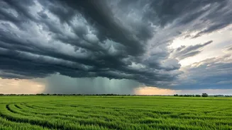
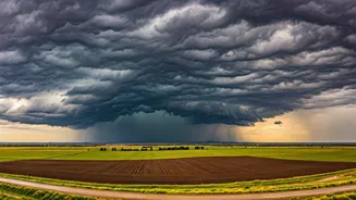
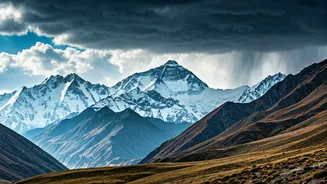
The showers currently lashing parts of Himachal Pradesh, Uttarakhand, and Jammu and Kashmir are not part of the main monsoon system. Instead, they are primarily caused by 'Western Disturbances' (WDs). These are extra-tropical storms originating in the Mediterranean
region that travel eastwards, gathering moisture along the way. When these moisture-laden systems hit the formidable barrier of the Himalayas, they are forced to rise, cool, and release their moisture as rain or snow in the higher altitudes. This phenomenon is a regular feature of the region's weather, especially during winter and spring, but their intensity and frequency during the pre-monsoon period are drawing attention.
Western Disturbance vs. Monsoon
It's crucial to understand the difference between these two weather systems. The southwest monsoon is a massive, seasonal wind system that originates over the Indian Ocean. It carries vast amounts of moisture and moves from sea to land, bringing widespread, sustained rainfall to the entire subcontinent over a period of months. In contrast, Western Disturbances are transient, shorter-lived systems that move from west to east. Their impact is largely confined to North and Northwest India, particularly the Himalayan states. While the monsoon is a warm, moisture-rich phenomenon, WDs are associated with cooler, cloudier conditions. The current rains are a classic pre-monsoon event, a curtain-raiser before the main act arrives.
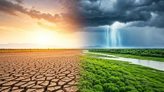
The Climate Change Connection
While Western Disturbances are normal, climate scientists are observing changes in their behaviour. Studies suggest that a warming Arctic and warmer sea surface temperatures in the Arabian Sea may be influencing the intensity and track of these disturbances. Some research indicates that WDs are becoming more frequent and intense during the pre-monsoon and monsoon seasons. This can lead to extreme rainfall events in the mountains, happening out of sync with the traditional monsoon calendar. The increased moisture-holding capacity of a warmer atmosphere means that when it does rain, it can pour, heightening the risk of catastrophic events.
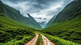
Impacts on the Ground
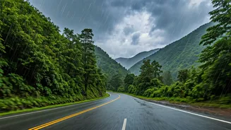
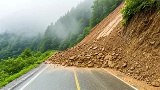
For the Himalayan region, these early rains are a double-edged sword. On one hand, they help replenish water sources like springs and streams, and are beneficial for apple orchards and other temperate crops before the summer heat sets in. They can also help douse forest fires that are common in this dry season. However, the downside is significant. Intense, unseasonal rain on fragile, soil-covered slopes can trigger landslides and flash floods, posing a severe threat to life, property, and infrastructure like roads and dams. For the booming tourism industry, sudden downpours can disrupt travel plans and create hazardous conditions, as seen with recent road blockages and travel advisories.
What This Means for the Plains
The weather in the Himalayas has a direct bearing on the plains below. The Himalayan rivers, which are the lifeline for hundreds of millions of people in the Indo-Gangetic plains, are fed by both snowmelt and rainfall. While these pre-monsoon showers contribute to river flow, they don't signify the monsoon's performance for the rest of the country. The India Meteorological Department (IMD) tracks the monsoon's advance as a separate, larger system. However, the interaction between a lingering Western Disturbance and the advancing monsoon currents can sometimes lead to explosive cloudbursts and extreme rainfall in the foothills, a dangerous combination that weather forecasters watch closely each year.