




The Planetary Data Deluge
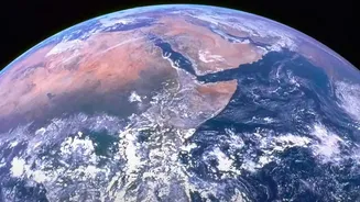
For decades, NASA has been our eyes in the sky, using a fleet of advanced satellites to monitor Earth's oceans, atmosphere, and land. These instruments generate a constant stream of information, adding up to nearly 180 petabytes of data archived over
the last five decades. To put that in perspective, if you took a high-resolution photo every second, it would take you centuries to accumulate that much data. This incredible resource is crucial for tracking climate trends, but its sheer volume presents a monumental challenge. For human researchers, manually analyzing this data to find subtle but critical patterns is an impossibly slow task, creating a bottleneck between data collection and scientific insight.
AI as the Scientist's Co-Pilot
This is where artificial intelligence comes in, not as a replacement for human scientists, but as a powerful co-pilot. AI, and specifically machine learning, excels at recognizing patterns in massive datasets. NASA is now deploying AI models to sift through decades of climate information, flagging anomalies and identifying trends that would be too time-consuming for humans to detect. According to NASA officials, the goal is to shrink the time between data collection and scientific understanding, allowing researchers to work faster and more efficiently. This partnership allows scientists to focus on interpretation and discovery, while AI handles the heavy lifting of data processing.
A New Foundation for Climate Science
One of the most significant breakthroughs is a collaboration between NASA and IBM to create a new AI foundation model for weather and climate. Dubbed "Prithvi-weather-climate" (Prithvi is Sanskrit for Earth), this model was trained on 40 years of NASA's historical weather data. This open-source tool allows researchers to tackle a wide range of problems, from short-term weather forecasting to long-term climate projections. For example, the model can be used to dramatically increase the resolution of climate simulations, a process known as downscaling. What a traditional model might see as a 150-square-kilometer area can be viewed in 12.5-square-kilometer segments, providing a much clearer picture of regional climate impacts like intense rainfall.
Fighting Wildfires from Space
The impact of this technology is especially clear in the fight against natural disasters like wildfires. NASA is developing new compact sensors, some the size of a shoebox, that use onboard AI to process thermal imagery in real-time. These tools, like the Compact Fire Imager (CFI), can detect a fire's heat signature and automatically identify the most critical data to send to firefighters on the ground. This significantly reduces the time it takes to get actionable information to first responders. Other projects involve creating "digital twins" of wildfires, which use AI to merge satellite, airborne, and ground data to forecast a fire's potential path in real-time. These models can run on a laptop or even a tablet in the field, giving fire crews an invaluable predictive tool where internet and computing power are limited.
Transforming the Future of Research
By making these AI tools and the underlying data openly available, NASA is aiming to lower the barrier of entry for researchers around the world. The Prithvi-weather-climate model, for instance, is available on Hugging Face, a public repository for open-source AI. This open-science approach is designed to accelerate discovery and empower decision-makers. As Karen St. Germain, director of NASA's Earth Science Division, noted, the goal is to produce tools that people can use to inform decisions on how to prepare for, respond to, and mitigate the effects of a changing climate. The technology is not just about better science; it's about turning that science into action.