
A New Kind of Vision for Earth
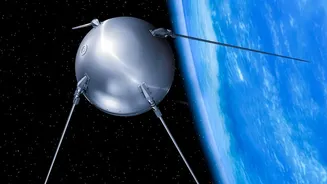
Launched in July 2025, NISAR is a sophisticated Earth-observation satellite born from a partnership between NASA and the Indian Space Research Organisation (ISRO). It is the world's first satellite to use two different radar frequencies—L-band and S-band—to
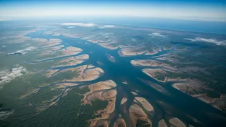
create incredibly detailed images of our planet's surface. Unlike optical satellites that are blinded by clouds or darkness, NISAR's radar penetrates these obstacles, providing an uninterrupted view of Earth day and night. It circles the globe every 12 days, systematically scanning nearly all of Earth's land and ice. This allows it to detect subtle changes, as small as a centimetre, which are crucial for understanding everything from earthquakes to the melting of glaciers.
The Old Model: Data Behind a Paywall
For decades, the most advanced, high-resolution Earth observation data has been treated like a precious commodity. It was often expensive and proprietary, accessible only to governments or well-funded corporations and research institutions that could afford the steep licensing fees. This model created a significant barrier, limiting the use of this vital information. Small businesses, academic researchers in developing nations, and disaster response organisations often couldn't access the timely data needed for innovation or emergency management. The full societal and economic potential of Earth observation remained locked away, benefiting only a select few.
NISAR's Open Data Revolution
NISAR completely upends that old model. In a landmark decision, both NASA and ISRO committed to a free and open data policy. All of NISAR's science data, from both the L-band and S-band radars, is available for anyone to download and use. As of July 2026, fully calibrated global data products are being released, with ISRO providing S-band data via its Bhoonidhi portal and NASA archiving data at the Alaska Satellite Facility. This move follows the proven success of programs like Landsat, where an open policy in 2008 led to an explosion in data use, scientific applications, and economic value. By making its data radically accessible, NISAR democratises Earth science, transforming it from a niche field into a global public utility.
Unlocking Innovation and Saving Lives
The implications of this open access are immense. For entrepreneurs and developers, it’s a goldmine. They can build new applications for agriculture, insurance, and resource management without the prohibitive cost of data acquisition. For scientists, it provides an unprecedented, consistent dataset to monitor climate change impacts, such as ice sheet collapse and sea-level rise. Most critically, it enhances disaster management. During a flood, for example, emergency responders can get clear, up-to-date maps of affected areas, even through storm clouds, enabling faster and more effective rescue efforts. NISAR has already demonstrated this capability by imaging floods in Mozambique in early 2026, providing clarity where optical satellites only saw clouds.
A Transformative Boon for India
For India, a key partner in the mission, the benefits are particularly profound. ISRO specifically advocated for the S-band radar to address national priorities. The data will be invaluable for monitoring the health of Himalayan glaciers, which are a critical water source for hundreds of millions. It will help manage agricultural resources by tracking crop health and soil moisture, bolstering food security. Furthermore, it will improve the nation's ability to respond to natural hazards like landslides, earthquakes, and cyclones. ISRO is already encouraging Indian researchers to develop new tools and services through its NISAR Utilisation Programme, ensuring the data is translated into tangible benefits for the country.