








A New Sentinel in Geostationary Orbit
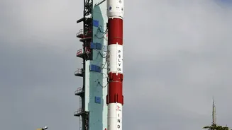
On September 4, 2026, the Indian Space Research Organisation (ISRO) successfully launched the advanced Earth Observation Satellite, EOS-05. Unlike many of its predecessors that circle the Earth in Low Earth Orbit, EOS-05 was placed in a geosynchronous
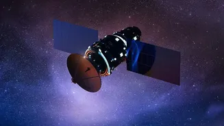
orbit approximately 36,000 kilometres high. This unique position allows it to remain stationary over the Indian subcontinent, providing a constant and uninterrupted view. Instead of getting brief glimpses of locations as it passes over, EOS-05 can stare at a vast region, making it an ideal platform for monitoring dynamic and rapidly evolving events like weather patterns and natural disasters. This mission marks a significant leap for India, establishing its first dedicated imaging satellite in this high-altitude orbit.
Transforming Weather Forecasting
One of the satellite's primary roles is to enhance weather monitoring. Its ability to provide near real-time imagery of the Indian landmass and surrounding oceans is a game-changer for meteorologists. Armed with advanced imagers, EOS-05 can track the formation and movement of cyclones, monitor the progress of the monsoon, and detect severe weather phenomena with greater frequency and accuracy. While ISRO's INSAT series has long been the backbone of meteorological services, EOS-05 adds a powerful, persistent monitoring capability. It can capture images of the entire country every half hour and focus on specific areas of interest every five minutes, giving forecasters the data needed for more precise and timely warnings that help save lives and protect property.
A Game-Changer for Indian Agriculture
Beyond weather, EOS-05 offers immense benefits for India's agricultural sector. Continuous monitoring from space provides invaluable data for what is known as 'precision agriculture'. The satellite's multi-spectral and hyper-spectral cameras can assess crop health over vast areas by analyzing the light reflected from fields. This helps in identifying water stress, nutrient deficiencies, or pest attacks early on, allowing for targeted interventions. Furthermore, the data aids in estimating soil moisture levels, which is crucial for irrigation planning, and helps in generating more accurate crop yield predictions. This information empowers farmers to make better decisions, optimize the use of resources like water and fertilisers, and ultimately improve their productivity and income.
Bolstering Disaster Management and More
The constant watch offered by EOS-05 is also critical for disaster management. In the event of floods, cloudbursts, or forest fires, the satellite can provide rapid, large-scale assessments of the affected areas, even when they are obscured by clouds. This capability, similar to that of radar imaging satellites like EOS-04, helps authorities plan and execute rescue and relief operations more effectively. The satellite's data also supports a wide range of other applications, including monitoring water bodies, tracking environmental changes, and even providing information for strategic and security purposes. This versatility makes it a national asset with far-reaching impacts on both civilian life and national security.
The Technology Behind the Vision
The power of EOS-05 lies in its sophisticated payload. It carries advanced imaging instruments, including multispectral and hyperspectral sensors capable of seeing the Earth in various wavelengths of light. These sensors gather information that is invisible to the human eye, providing detailed insights into everything from atmospheric water vapour to vegetation health. The satellite's geostationary position means it can deliver this data with a frequency that low-orbit satellites cannot match. This combination of advanced sensors and a persistent vantage point is what enhances India's monitoring capabilities so significantly, building upon the foundation laid by previous Earth observation missions and integrating with other crucial satellite systems to provide a comprehensive picture of our planet.