




What Exactly Are IoT Water Sensors?
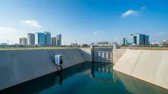
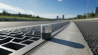
Think of them as smart, tireless watchmen for our waterways and drains. An IoT water level sensor is a device that measures the height of water in a specific location—like a river, a stormwater drain, or a reservoir—and communicates that data over the internet.
These aren't just simple float switches. Modern sensors often use ultrasonic pulses or radar to measure water levels without even touching the water, making them durable and accurate. They are connected to a network, forming an intelligent system that provides a constant, real-time view of what’s happening in a city's water channels.
From a Trickle of Data to a Flood of Information
The real power isn’t in a single sensor but in the network. Here’s a simplified breakdown of the process. First, sensors across the city collect water level data continuously. This data is then transmitted wirelessly using low-power, long-range networks (like LoRaWAN) to a central cloud platform. This is where the magic happens. The platform aggregates data from hundreds of sensors, combining it with other information like weather forecasts and rainfall intensity. When the system detects that water levels are rising to a dangerous threshold in a particular area, it can trigger automated alerts.
The Critical Advantage of Real-Time Alerts
In a flash flood, every minute counts. Traditional flood management often relies on manual inspections or delayed reports, which are too slow for rapidly changing conditions. IoT systems provide instantaneous warnings. This real-time data allows municipal authorities to make swift, informed decisions. They can issue targeted evacuation warnings to specific neighbourhoods, reroute traffic away from flooded underpasses, and dispatch emergency services to high-risk zones before they become inaccessible. This proactive approach saves lives, reduces property damage, and minimises economic disruption.
Beyond Warnings: Predicting the Future
The most advanced systems don't just react—they predict. By feeding the continuous stream of real-time data into Artificial Intelligence (AI) and Machine Learning (ML) models, authorities can forecast where and when flooding will occur with remarkable accuracy—sometimes up to 48 or 72 hours in advance. These AI models analyse historical flood patterns, current soil moisture, rainfall data, and the city's drainage capacity to create predictive maps. This allows for strategic pre-deployment of resources like temporary flood barriers and pumps, turning disaster response into proactive disaster prevention.
Implementation in the Indian Context
Indian cities, with their dense populations and vulnerability to monsoonal flooding, are prime candidates for this technology. Several smart city projects are already exploring and deploying these systems. For instance, researchers at IIT Bombay are using data from IoT monitoring networks to build AI models capable of providing 48-hour advance flood forecasts. While challenges like cost, network coverage, and sensor maintenance exist, the long-term benefits are clear. These systems create a wealth of historical data that can inform better urban planning, helping engineers design more resilient drainage infrastructure for the future and avoid building in chronically flood-prone zones.