


What's Happening in the Hills?
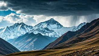
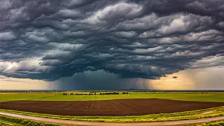
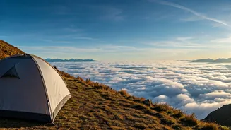
Residents and tourists in states like Himachal Pradesh and Uttarakhand have witnessed an unexpectedly early arrival of significant rainfall this season. These pre-monsoon showers, characterized by intense but often brief downpours, thunderstorms, and even
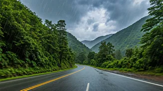
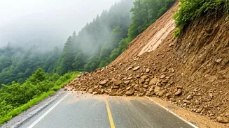
hail, have arrived well before the typical timeline. While they have brought a welcome dip in temperatures, providing relief from the building summer heat, they have also raised concerns. The early, intense precipitation on dry, unprepared slopes increases the risk of landslides and flash floods, a recurring danger in the fragile Himalayan ecosystem. This activity is happening while the rest of the country is still anxiously awaiting the official declaration of the Southwest Monsoon's arrival.
Is This the Real Monsoon?
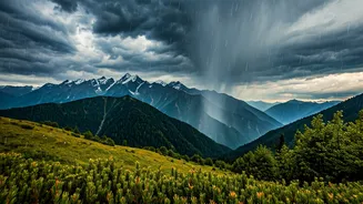
In short, no. This is the most crucial point to understand. The rains currently seen in the upper reaches of India are primarily caused by 'Western Disturbances'. These are extratropical storms that originate in the Mediterranean region. They travel across the Middle East and Pakistan, gathering moisture, and release it as rain or snow upon encountering the high Himalayan barrier. While they are a vital source of winter and spring precipitation for North India, they are a completely different weather system from the Southwest Monsoon. The monsoon is a seasonal wind system powered by the temperature difference between the hot Indian landmass and the cooler Indian Ocean, bringing widespread, sustained rain across the entire subcontinent.
The Kerala Connection: Official Start
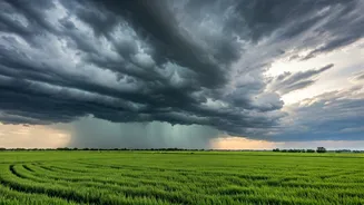
The official onset of the Indian monsoon season is traditionally marked by its arrival over the coast of Kerala. The India Meteorological Department (IMD) has a very specific set of criteria for this declaration, based on rainfall intensity, wind speed, and other atmospheric conditions. This event is the starting pistol for a four-month rainy season that progresses northward across the country in a relatively predictable pattern. The timing of the monsoon's arrival in Kerala is what meteorologists and an entire nation of farmers track closely. Therefore, the pre-monsoon showers in the Himalayas have little to no bearing on when the monsoon will officially begin its journey over the southern tip of the peninsula.
What Does This Mean for the Plains?
For those living in the plains of North and Central India, the early Himalayan rains are not a reliable signal for an early monsoon in their own backyards. The arrival and progression of the Southwest Monsoon depend on large-scale atmospheric and oceanic conditions, which are tracked independently by the IMD. While a strong Western Disturbance can sometimes interact with monsoon winds later in the season, it doesn't typically advance the monsoon's main front. The forecast for cities like Delhi, Lucknow, or Jaipur remains tied to the official progression of the monsoon after it makes landfall in Kerala. The current heatwaves and dry conditions in the plains are expected to continue until the monsoon trough arrives as per its own schedule.
The Bigger Climate Picture
While these specific rains are caused by a Western Disturbance, the increasing frequency and intensity of such unseasonal weather events are drawing the attention of climate scientists. Research suggests that climate change is altering the behaviour of both Western Disturbances and the monsoon. Some studies indicate that Western Disturbances are becoming more frequent and intense during the pre-monsoon and summer months. This shift can lead to more extreme weather events — like the flash floods in Kedarnath in 2013, which was a result of a devastating interaction between a Western Disturbance and monsoonal winds. So, while this current spell may be a distinct weather event, it fits a broader pattern of more erratic and intense weather phenomena that India must prepare for.