






From Broad Strokes to Local Focus
For years, weather forecasts felt like broad predictions for an entire state. But the IMD has shifted to a more granular, life-saving approach: district-level warnings. This move is part of an 'Impact Based Forecasting' system designed to provide actionable
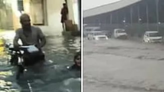
advice. Instead of just stating that "heavy rain is likely," the system now aims to specify the potential consequences, such as "waterlogging on major roads" or "risk of landslides in hilly areas." This detailed approach is crucial because the impact of the same amount of rainfall can vary dramatically from one district to another based on geography, infrastructure, and population density. These forecasts empower local authorities, like the District Collector, to make timely decisions, such as closing schools or restricting traffic on vulnerable routes, ensuring public safety.
Decoding the Colour Code: Your Guide
The IMD uses a four-colour system to communicate the severity of the weather. Understanding this is the first step to making smarter travel choices. A 'Green' alert means all is well and no advisory is needed. A 'Yellow' alert means 'Be Aware'; it signals that weather could worsen and cause minor disruptions. This is your cue to stay updated and allow extra travel time. An 'Orange' alert means 'Be Prepared'. This indicates that extremely bad weather is likely, with a high chance of travel delays, rail and road closures, and power cuts. Finally, a 'Red' alert means 'Take Action'. Issued for the most severe conditions, it warns of a significant threat to life and property. During a red alert, all non-essential travel should be avoided.
How to Plan Your Monsoon Travel
So, how do you use this for your weekend getaway or family visit? The key is to plan ahead. Start by downloading the official 'Mausam' app from the IMD. It provides district-wise forecasts and colour-coded warnings for up to five days, along with three-hourly 'nowcasts' for immediate local conditions. If you're planning a road trip, the IMD website also has route-specific highway forecasts that show expected weather along your entire journey. For example, if you see an Orange alert for a district you'll be driving through, consider altering your departure time or route. If a Red alert is issued for your destination or a key transit area, the safest decision is to postpone your trip. Always check for specific impact warnings, like 'flash floods' or 'landslides,' which provide more context than the colour alone.
Beyond the Apps: On-the-Ground Reality
While IMD provides the forecast, the final decisions on local restrictions are made by district and state authorities. A weather warning is a trigger for these bodies to act. You might see news reports of a District Magistrate ordering schools to close or restricting movement in tourist spots based on an IMD alert. It's crucial to follow these local advisories, which are often disseminated through local news channels and official social media handles. Remember that even a Yellow alert in a hilly or landslide-prone region can be more dangerous than an Orange alert in a plains district. Always consider the local geography and infrastructure when interpreting a weather warning for travel. Combining the IMD's scientific forecast with official local advisories gives you the most complete picture for a safe journey.