








An Intensified Western Monsoon
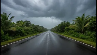
The first major system involves a powerful and active phase of the Southwest Monsoon lashing India's western coast. Cities like Mumbai and regions across the Konkan coast, Gujarat, and Karnataka have experienced extremely heavy rainfall, leading to severe
waterlogging, traffic disruption, and alerts from authorities. This monsoon surge is being fed by strong westerly winds from the Arabian Sea. An offshore trough, a feature that enhances rainfall, has been stubbornly sitting from the south Gujarat coast down to Kerala, continually pulling moisture onto the land. The India Meteorological Department (IMD) issued a series of 'red' and 'orange' alerts for these areas, warning of the deluge and advising residents to take precautions.
A Merger of Systems in the North
Simultaneously, a second complex weather scenario has been developing over the northern and central parts of the country. A well-marked low-pressure area, which originally weakened from a depression over East Madhya Pradesh, began interacting with a western disturbance moving across North India. This merger of two distinct weather systems has amplified rainfall, particularly over the Himalayan region. States like Uttarakhand have been put on high alert for heavy to very heavy rainfall, with officials warning of potential landslides and flash floods, especially between July 9 and 10. Heavy rains have also caused significant issues in Delhi and surrounding areas, with building collapses and flooded roads reported.
The View from 36,000 Kilometres Up
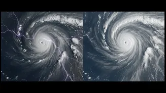
These events aren't just unfolding; they are being meticulously tracked. From geostationary orbit, Indian satellites like INSAT-3D and INSAT-3DR provide a constant stream of data that is far more than just pretty cloud pictures. These satellites are equipped with advanced imagers and sounders that observe the Earth in multiple wavelengths, including visible light, infrared, and water vapour channels. The infrared channels measure cloud-top temperatures, which help meteorologists determine the height and intensity of thunderclouds—the colder the top, the more powerful the storm. The water vapour imagery tracks the movement of atmospheric moisture, showing exactly where the fuel for these massive rain systems is coming from.
From Data to Life-Saving Alerts
For the western monsoon surge, satellite data allows the IMD to see the relentless plume of moisture flowing in from the Arabian Sea and identify the development of intense convective clouds before they hit the coast. This capability is crucial for issuing timely and specific warnings for extremely heavy rainfall. For the northern system, satellites enabled forecasters to watch the interaction between the low-pressure area and the western disturbance in real-time. By monitoring the cloud structures and moisture convergence, they could predict the intensification of rainfall over the vulnerable Himalayan states. This data feeds into computer models that generate forecasts, giving disaster management authorities a critical head start to prepare for the impact. The ability to rapidly scan developing cyclones and storm systems is another key feature, enhancing forecast accuracy when it matters most.