


Forecasting Weather with Pinpoint Accuracy
For a country as dependent on the monsoon as India, accurate weather forecasting is not just a convenience; it's a lifeline. For decades, predictions were broad and often unreliable. Today, a network of advanced satellites, including the Indian National
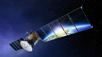
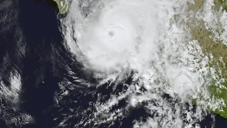
Satellite (INSAT) series, has changed the game. Satellites like INSAT-3D and INSAT-3DR orbit the earth, providing continuous data on cloud patterns, sea surface temperatures, and humidity every 15 to 30 minutes. This constant stream of information allows the India Meteorological Department (IMD) to track the development of weather systems in real-time. The most significant impact has been on cyclone prediction. By monitoring the formation of low-pressure areas over the ocean, forecasters can issue warnings several days in advance, giving authorities crucial time to prepare and evacuate coastal areas, saving countless lives. The recently launched EOS-05 satellite, operating from a high geosynchronous orbit, further enhances this capability by providing near real-time imaging for continuous monitoring of the Indian subcontinent.
The Farmer’s New Ally in the Sky
Beyond life-saving weather alerts, satellite technology is quietly transforming Indian agriculture from the ground up. With over half of India's population employed in agriculture, any improvement in efficiency has a massive economic and social impact. Remote sensing satellites provide a wealth of data that was previously unimaginable. They can assess soil moisture levels, monitor crop health by analysing how plants reflect light, and even estimate crop acreage and predict yields for staple crops like rice and wheat. This move towards 'precision agriculture' allows for the optimised use of resources. For instance, satellite imagery can pinpoint which parts of a field need more water or fertiliser, helping farmers reduce costs and minimise environmental impact. This data is no longer just for scientists; it's being delivered directly to farmers through mobile apps and government advisory services.
Data-Driven Farming in Action
The Indian Space Research Organisation (ISRO) has been at the forefront of this revolution, developing programmes that translate complex satellite data into actionable advice for farmers. Initiatives like FASAL (Forecasting Agricultural output using Space, Agro-meteorology and Land-based observations) provide vital pre-season crop forecasts. Another programme, Krishi-Decision Support System (Krishi-DSS), offers a platform that gives farmers real-time data on everything from weather to pest outbreaks. These tools help farmers make informed decisions, such as selecting the right crops for their soil, determining the optimal time for planting and harvesting, and managing irrigation more effectively. This data-driven approach also extends to crop insurance, where satellite imagery is used to quickly and accurately assess damage after natural disasters like floods or droughts, ensuring faster compensation for affected farmers.
Managing Droughts and Water Resources
A satellite's view is particularly powerful in managing India's most precious resource: water. The National Agricultural Drought Assessment and Monitoring System (NADAMS) uses satellite data to provide early warnings of drought conditions. By monitoring vegetation health and surface water levels over large areas, officials can declare a drought and implement mitigation measures much earlier than before. Satellites also play a critical role in managing water resources more broadly. They help in assessing the water levels in reservoirs, mapping flood-affected areas during heavy rains, and even studying the health of glaciers in the Himalayas, which are a vital source of water for India's northern rivers. This holistic view enables better long-term planning for water security across the nation.