







A New Sentinel in the Sky
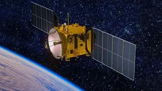
The Indian Space Research Organisation (ISRO) has successfully launched its Earth Observation Satellite, EOS-05, aboard the GSLV-F17 rocket. Also known as Gisat-1A, this isn't just another satellite; it's India's first imaging satellite to be placed in a geosynchronous
orbit, approximately 36,000 kilometres above the Earth. This launch marks a significant milestone, providing India with a dedicated 'eye in the sky' capable of constant vigil. The mission is a successor to the GISAT-1, which was lost in a launch failure in 2021, making this successful deployment a moment of strategic and emotional significance for the space agency. Weighing around 2,367 kg, the spacecraft is equipped with advanced imaging payloads designed for both civilian and military applications.
The Geostationary Advantage
The true game-changer for EOS-05 is its geostationary orbit. Most Earth observation satellites, like those in the Cartosat series, are in Low Earth Orbit (LEO), circling the planet and passing over a specific location only at certain times. In contrast, a satellite in geostationary orbit matches the speed of the Earth's rotation. This means from the ground, EOS-05 appears to hover over a fixed point, allowing it to watch the same large area continuously. This eliminates the time gap between observations, which can be days for LEO satellites, and provides a constant, real-time feed. For surveillance, this is a massive leap from getting periodic snapshots to having a persistent stare, which is crucial for monitoring fluid situations along the borders.
What Can It Actually See?
EOS-05 is equipped with high-resolution and multi-spectral imagers. This allows it to see in different wavelengths of light, gathering detailed information day and night. While most imaging satellites can be blinded by cloud cover or darkness, advanced systems can provide all-weather capability. For border surveillance, this means the ability to detect changes in terrain, monitor the movement of troops and vehicles, and spot the construction of new infrastructure in sensitive areas. According to mission profiles for this type of satellite, it can provide near-real-time imagery of the entire Indian subcontinent every 30 minutes, and can be tasked to focus on a priority area with a revisit time as short as five minutes. This rapid-cadence imaging is invaluable for tracking fast-moving events.
Strengthening the National Security Grid
This launch is a significant force multiplier for India's national security apparatus. It complements the government's broader 'Smart Border' initiative, which aims to integrate technology like AI, drones, and sensors to secure the country's vast land borders. While drones and ground sensors provide close-up intelligence, a geostationary satellite offers the bigger picture, providing strategic oversight and early warnings. It allows security forces to direct and coordinate ground assets more effectively. This new capability adds a critical space-based layer to the multi-tiered surveillance network India is building to manage its complex frontiers, especially in regions where physical fencing or patrolling is difficult.
Beyond Borders: A Dual-Use Marvel
While border security is a primary driver, the applications of EOS-05 extend far beyond defence. The same persistent monitoring is incredibly valuable for civilian purposes. The satellite will be able to track the development and progression of cyclones, thunderstorms, and other severe weather events in near real-time, providing crucial data for disaster management agencies. It can also be used for environmental monitoring, such as tracking forest fires, assessing agricultural health, and monitoring water bodies and glaciers. This dual-use capability is a hallmark of ISRO's approach, ensuring that investments in space technology yield broad benefits for the nation's economy and its citizens' safety.