








India’s Eyes on the Ocean
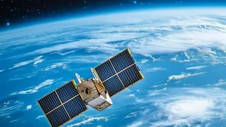
Since 1999, the Indian Space Research Organisation (ISRO) has been operating a series of Earth observation satellites dedicated to studying our oceans. This program, known as OceanSat, began with the launch of OceanSat-1 and has evolved with subsequent
missions like OceanSat-2 (2009) and the most recent, OceanSat-3 (also called EOS-06), which launched in November 2022. These satellites are placed in a polar sun-synchronous orbit, allowing them to scan the entire globe from a height of over 700 kilometres. Their primary mission is to systematically gather data on the physical and biological processes of the oceans, providing crucial information for a wide range of applications that directly impact India’s economy and safety.
Decoding the Colour of Water
The magic behind OceanSat lies in a key instrument called the Ocean Colour Monitor (OCM). This highly sensitive camera observes the ocean in multiple spectral bands, from visible to near-infrared light. But why does the colour of the ocean matter? The subtle variations in hue tell scientists a story about what’s in the water. Specifically, the OCM measures the concentration of chlorophyll, the pigment found in microscopic marine plants called phytoplankton. These tiny organisms form the base of the marine food web. Where there is an abundance of phytoplankton, there is often an abundance of fish. The satellite can distinguish between the deep blue of barren ocean and the greenish tints that signal a thriving underwater ecosystem.
Guiding Fishermen to a Better Catch
This ability to detect phytoplankton is the foundation of one of OceanSat's most impactful applications: Potential Fishing Zone (PFZ) advisories. Data on chlorophyll concentration from the OCM is combined with sea surface temperature (SST) data to identify areas where fish are likely to congregate. These advisories are then disseminated to fishing communities across India by the Indian National Centre for Ocean Information Services (INCOIS). For fishermen, this information is revolutionary. Instead of spending hours and valuable fuel searching blindly, they can head directly to promising locations. Studies have shown this service significantly increases catches, saves enormous amounts of diesel, and boosts the income of coastal communities, making fishing more profitable and sustainable.
A Watchful Eye on Weather
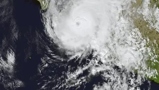
Beyond fishing, the OceanSat series plays a vital role in weather forecasting and disaster management. The satellites are equipped with instruments like scatterometers and sea surface temperature monitors. The scatterometer measures wind speed and direction over the ocean surface by bouncing radar beams off the water. This is critical for tracking the formation and intensification of cyclones in the Bay of Bengal and the Arabian Sea. Sea surface temperature is another crucial factor, as warm waters provide the energy that fuels these powerful storms. By providing accurate, real-time data on these parameters, OceanSat gives forecasters the tools they need to issue timely and accurate cyclone warnings, saving countless lives.
The Future of Ocean Monitoring
The latest satellite, OceanSat-3 (EOS-06), represents a significant leap forward. Its advanced 13-band OCM provides more detailed data than its predecessors. The combination of a high-resolution colour monitor, a scatterometer, and a sea surface temperature monitor on a single platform allows for a more holistic understanding of ocean dynamics. The applications continue to expand, from monitoring harmful algal blooms and coastal water pollution to studying the ocean's role in climate change. As ISRO continues to develop and improve upon this technology, the OceanSat series will remain a cornerstone of India’s blue economy, using space-based insights to foster prosperity and ensure the safety of its coastal population.