




Know the Key Dates and Affected Zones
The first step to accurate travel planning is knowing when and where the diversions will be most intense. In 2026, the Shravan month in North India begins on July 30 and concludes on August 28. The associated Kanwar Yatra will commence on July 30, with
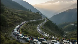
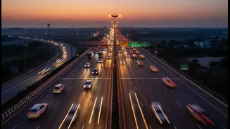
pilgrim numbers peaking for the Sawan Shivratri jalabhishek on Tuesday, August 11. Major travel disruption can be expected for roughly two weeks leading up to this date. The primary corridors affected are those leading to Haridwar, a major collection point for holy Ganga water. This includes National Highway 34 (formerly NH-58) through Meerut and Muzaffarnagar, the Delhi-Meerut Expressway, and routes connecting Delhi, Ghaziabad, and parts of Haryana and Rajasthan. Authorities in Delhi and surrounding NCR districts coordinate to manage traffic, often banning heavy vehicles first, followed by closures for general traffic during the busiest periods.
Master Your Digital Navigation Toolkit
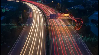
Standard navigation apps are essential, but you need to use their features smartly. Google Maps and Waze are powerful because they use real-time, user-generated data to reflect current road conditions. Instead of just accepting the initial Estimated Time of Arrival (ETA), actively look at the route. Check the 'Layers' option in Google Maps to enable the 'Traffic' view, which will colour-code roads based on congestion. Waze is particularly strong on user-reported hazards like road closures, accidents, and police presence. Don't forget to check official sources, too. Local traffic police in cities like Ghaziabad and Delhi issue specific advisories and diversion plans just before and during the Yatra. Searching for these advisories on official police websites or their social media handles provides a definitive look at planned closures.
Go Beyond the App's First Suggestion
An app's ETA is a dynamic calculation based on current speeds and known closures. During the Kanwar Yatra, conditions can change rapidly. Don't blindly trust the first route suggested. Use the 'alternative routes' feature to see other options. Sometimes a slightly longer route that avoids major Kanwar arteries can be significantly faster. On a desktop, Google Maps allows you to manually drag your route to force it onto different roads, letting you compare the time difference yourself. You can also add multiple stops to your journey. By adding a town or landmark that is on a known clear route as a midway 'stop', you can force the app to navigate away from the most congested corridors. This allows you to build a more realistic route based on official diversion plans, rather than relying on the app to figure it out in real-time.
The Crucial Art of the Buffer
No ETA is perfectly precise during this period. The only way to ensure an on-time arrival is to build in a generous buffer. For inter-city travel on affected corridors, a common-sense approach is to add at least 30-50% to the app’s initial travel time estimate. For a trip that Google Maps says will take three hours, plan for it to take four to four-and-a-half hours. This buffer accounts for unpredictable bottlenecks, sudden increases in pilgrim foot traffic, and temporary holds by local police that apps cannot foresee. For critical travel, like catching a flight or attending an important event, increasing the buffer even further is a wise precaution. It is far better to arrive an hour early than ten minutes late.
Leverage Local and Alternative Intel
Digital tools are powerful, but on-the-ground intelligence is invaluable. If travelling to a hotel or relative's house, call them before you leave. They will have a much better sense of the local ground reality than any app. Social media groups dedicated to local city traffic can also be a goldmine of real-time information shared by other commuters. Finally, if your journey is flexible, consider the timing. Starting your travel very early in the morning (before 6 AM) can help you get ahead of the main traffic build-up. For longer journeys, especially to destinations like Dehradun or Rishikesh, bypassing the main road routes entirely by opting for a train or a flight into Jolly Grant Airport might be the most stress-free and time-predictable option.