





The Annual Monsoon Travel Gamble
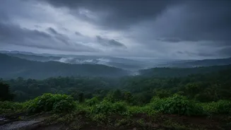
For millions, travelling during the monsoon is not a choice but a necessity. Yet, it remains a gamble. A sunny start can quickly turn into a nightmare of waterlogged roads, flash floods, and terrifying landslides, particularly in hilly regions. City-wide
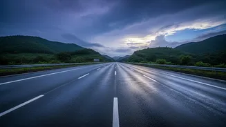
or even district-wide forecasts, while useful, often fail to capture the specific dangers lurking along a 300-kilometre highway. A generic "heavy rain likely" warning for a state provides little actionable intelligence for a family driving to a wedding, a trucker transporting essential goods, or a pilgrim undertaking a sacred journey. This uncertainty forces travellers into a reactive mode, dealing with disruptions as they happen rather than proactively planning around them, leading to significant economic losses and, tragically, loss of life.
What Exactly Are Route-Level Forecasts?
Imagine a weather forecast that isn’t for your destination, but for your entire journey. That’s the core of the IMD's route-specific forecasting. Instead of a single prediction for a large area, this system provides dynamic, real-time and forecasted weather updates mapped across specific travel corridors. A driver embarking on a journey can see the expected weather conditions, temperature, and wind not just at the start and end points, but at various stages along the way. The service warns about specific hazards like heavy rain, thunderstorms, intense spells of rain, and potential landslides for vulnerable stretches, moving weather prediction from a broad overview to a granular, journey-centric advisory service.
The Science Behind the Safety
This leap in forecasting precision is powered by a combination of advanced technology and artificial intelligence. The IMD now integrates data from a vastly expanded network of Doppler radars, satellites, and automatic weather stations. This information is fed into sophisticated AI models, which can then downscale broad predictions to a hyperlocal level—in some cases, with a resolution as fine as one square kilometre. One such system, developed by the Indian Institute of Tropical Meteorology, blends multiple forecast models and historical data to sharpen accuracy, allowing for probabilistic forecasts for up to four weeks in advance. For highways, Geographic Information System (GIS) technology plays a crucial role, overlaying this detailed weather data onto road maps to create an interactive and easy-to-understand visual forecast for travellers.
Covering Critical Corridors
The initial focus of these services has been on India's most critical and vulnerable routes. The IMD's portal provides specialised highway forecasts for states like Maharashtra, Gujarat, Goa, Karnataka, Kerala, and Tamil Nadu. Particular emphasis is placed on pilgrimage routes that see heavy traffic during the treacherous monsoon months. For example, the Char Dham Yatra in Uttarakhand, where heavy rains frequently trigger landslides and suspend travel, receives dedicated, location-specific warnings for key points like Gangotri and Badrinath. These forecasts provide advance warnings on intense rainfall and thunderstorms, allowing authorities and pilgrims to make informed decisions about continuing their journey, sometimes leading to the temporary suspension of the yatra for safety.
More Than Just Avoiding a Downpour
The implications of route-level forecasting extend far beyond individual convenience. For the logistics industry, it means smarter routing decisions, reducing delays and protecting cargo. For disaster management agencies, it provides the specific intelligence needed to pre-position response teams in high-risk areas before a landslide occurs. For the agricultural sector, similar hyperlocal 'block-level' forecasts are empowering farmers to make precise decisions about sowing and irrigation, securing their livelihoods against weather-related risks. Ultimately, this technology represents a shift from simply predicting the weather to managing its impact. It empowers every citizen, from a farmer in Uttar Pradesh to a driver on the Mumbai-Pune Expressway, with the information they need to make safer, smarter decisions in the face of an increasingly unpredictable climate.