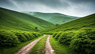


A Fragile Paradise Under Siege
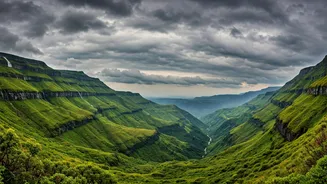
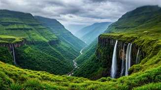
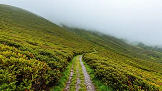
The Western Ghats, with their lush forests and unique biodiversity, are not just a scenic marvel; they are a critical ecological and economic zone. However, this vibrant landscape is becoming a hotspot for climate-induced disasters. Recent years have
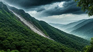
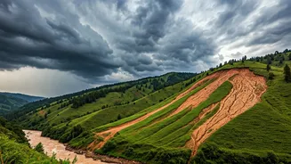
seen a terrifying increase in the frequency and intensity of torrential rain, leading to devastating landslides and flash floods. Incidents that were once considered rare are now a grim, annual reality for communities in states like Kerala, Karnataka, and Tamil Nadu. The combination of steep slopes, fragile soil, and increasingly erratic and intense rainfall creates a perfect storm for disaster. Studies show that human-induced climate change is making these rainfall events more severe, turning seasonal monsoons into catastrophic events. The very geography that makes the Ghats beautiful also makes them incredibly vulnerable.
The Human Cost of Delayed Warnings
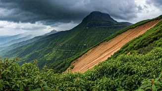
When a hillside gives way or a river swells in minutes, the consequences are measured in lost lives, homes, and livelihoods. Across the Western Ghats, stories of loss are tragically common. In Karnataka alone, nearly 1,500 landslides were recorded between 2006 and 2023. These are not just statistics; they represent families displaced and entire villages facing an uncertain future. The issue is compounded by unplanned development and deforestation, which destabilise the natural terrain. While the India Meteorological Department (IMD) issues broader, state-level warnings, these often lack the granular detail needed for effective local action. A forecast for 'heavy rain' in a district is useful, but it doesn't tell a specific village on a vulnerable slope that it needs to evacuate immediately. This gap between macro-forecasts and micro-realities is where lives are put at risk.
The Challenge of Mountain Weather
Predicting weather in mountainous regions is notoriously difficult. Unlike the plains, the complex topography of the Ghats creates countless microclimates where conditions can change in an instant. Wind patterns, temperature, and rainfall can vary dramatically over just a few kilometres. Current weather prediction models, even with advancements, struggle to resolve these localised effects with perfect accuracy. This is a global challenge, but it has life-or-death implications in a densely populated and ecologically sensitive region like the Western Ghats. Without a dense network of ground-level monitoring stations providing continuous data, forecasters are often flying blind, unable to predict the precise location and timing of a sudden, intense downpour that could trigger a landslide.
The Real-Time Solution
The answer lies in embracing modern Internet of Things (IoT) technology. A dense network of low-cost, automatic weather stations (AWS) can provide a constant stream of hyper-local data on rainfall, soil moisture, humidity, and wind speed. This real-time information, fed into advanced analytical models, can generate highly specific, slope-level warnings. Imagine a system that automatically sends an alert to a village panchayat and residents' mobile phones when rainfall in their specific area crosses a critical threshold known to trigger landslides. This is not science fiction; the technology exists. In fact, the Indian government has already mandated similar real-time monitoring for large-scale solar and wind energy projects to improve grid stability, demonstrating that the capability is within reach. Applying this same principle to public safety is the logical and necessary next step.
Building a More Resilient Future
Implementing a real-time weather awareness network is an investment in resilience. It moves disaster management from a purely reactive exercise to a proactive one, empowering communities with the information they need to protect themselves. The IMD has already made strides by developing indigenous digital observation systems, aiming to phase them in across the country. The challenge now is to prioritise and accelerate their deployment in high-risk zones like the Western Ghats. Such a system would not only save lives but also provide invaluable data for better agricultural planning, water resource management, and infrastructure development. By understanding the weather with greater precision, we can learn to coexist with the powerful forces of nature that shape this vital region, protecting both the people and the paradise they call home.