






The Forest's Secret Climate Superpower
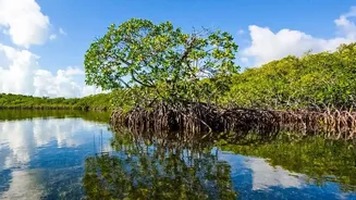
Spanning over 10,000 square kilometres across India and Bangladesh, the Sundarbans is more than just a critical habitat for the Royal Bengal Tiger; it's a global climate champion. This unique ecosystem is a powerhouse of 'blue carbon,' the carbon captured
and stored by coastal and marine ecosystems. Mangroves are exceptionally good at this, sequestering carbon at a rate up to four times higher than many terrestrial forests. They lock it away in their branches, roots (both above and below ground), and, most importantly, in the dense, muddy soil that has built up over centuries. This makes the Sundarbans a vital natural defence in the fight against climate change, holding a massive reservoir of carbon that must be protected from release into the atmosphere.
The Problem with Boots on the Ground
For decades, the only way to estimate the carbon stored in a forest was through painstaking fieldwork. Scientists would establish sample plots, measure tree height and diameter, and take soil cores. In the Sundarbans, this is a monumental challenge. The terrain is a labyrinth of shifting tidal creeks, impenetrable thickets of aerial roots, and deep, unstable mud. Access is difficult and often dangerous, limited by tides and the presence of wildlife. As a result, traditional methods can only ever provide a snapshot of small, localized areas. Extrapolating these findings across the entire, vast expanse of the forest is fraught with uncertainty and potential error, leaving a significant gap in our understanding. Given the sheer scale and inaccessibility, getting a complete and accurate picture through ground measurements alone is practically impossible.
An Eye in the Sky Provides the Solution
This is where satellite imaging becomes a game-changer. Remote sensing technologies allow scientists to overcome the physical barriers of the Sundarbans. Using a combination of optical and radar satellite data, researchers can map and monitor the entire forest with unprecedented detail. Optical sensors, like those on the Landsat or Sentinel-2 satellites, measure the greenness and density of the forest canopy. Radar and LiDAR (Light Detection and Ranging) instruments can penetrate cloud cover and even the forest canopy to provide three-dimensional data on tree height and structure. By combining this data with smaller-scale field measurements, scientists develop sophisticated models that can estimate the total above-ground biomass—and by extension, the carbon content—across the entire 10,000-square-kilometre ecosystem.
Accuracy and Scale for Real-World Impact
The critical advantage of satellite imaging is its ability to provide consistent, repeatable, and large-scale data. Instead of isolated measurements, researchers can create comprehensive maps of carbon stocks for the entire region. This technology allows for the monitoring of the forest's health over time, detecting changes caused by erosion, cyclones, deforestation, or restoration efforts. For example, after Cyclone Amphan in 2020, satellite data was crucial in assessing the widespread damage to the mangrove canopy. This level of comprehensive monitoring is not just an academic exercise; it has profound real-world implications. Accurate data is the foundation for effective conservation strategies, allowing authorities to target restoration efforts where they are needed most.
From Data to Climate Action and Conservation
Quantifying the Sundarbans' carbon stock is essential for India's climate policy and its participation in global climate initiatives. Reliable data, verified by satellite-based Measurement, Reporting, and Verification (MRV) systems, is a prerequisite for accessing international climate finance and participating in carbon markets. By putting a verifiable number on the amount of carbon stored, India can potentially generate carbon credits, creating a financial incentive for conservation that can be reinvested into protecting the ecosystem and supporting the local communities who depend on it. In essence, satellite imaging provides the proof needed to translate the ecological value of the Sundarbans into tangible economic and policy actions that ensure its long-term survival.