



A Groundbreaking India-US Partnership
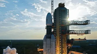
The NISAR (NASA-ISRO Synthetic Aperture Radar) mission is a landmark achievement in international scientific collaboration. It's the first time the two space agencies have partnered on hardware development for an Earth-observing mission, creating one
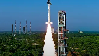
of the most advanced radar systems ever sent into space. Launched from India, the satellite is equipped with two distinct radar systems: NASA's L-band and ISRO's S-band. This dual-frequency capability allows it to observe our planet in unprecedented detail, day or night, and regardless of cloud cover. While ISRO identified key applications like monitoring Himalayan glaciers and agricultural land in India, the mission's global scope is providing game-changing data for scientists worldwide. All data from both radar bands is made freely and openly available to the public, ensuring its benefits are widespread.
Peering Beneath the Ice
What makes NISAR so revolutionary for polar science is its ability to see what optical satellites cannot. Its advanced radar penetrates clouds, darkness, and even layers of snow to reveal the complex dynamics of the ice below. Recent images from Antarctica showcase this power, revealing hidden structures and movements within glaciers. One striking image of a rocky mountaintop, or nunatak, obstructing a glacier's flow created a pattern of deep cracks that scientists nicknamed "the hummingbird." This isn't just a beautiful image; it's a visualization of the immense stress and fracturing happening within the ice sheet. The L-band radar is particularly effective at tracking the motion of ice, while the S-band is more sensitive to snow moisture, an indicator of melting. This combination gives scientists a comprehensive toolkit to study the continent year-round.
The Power of Precision and Repetition
Previous satellites offered snapshots of polar ice, but NISAR provides a time-lapse movie. It observes nearly every land and ice surface on Earth twice every 12 days. This consistent, repeating coverage allows scientists to track changes with incredible precision, detecting movements on the scale of a single centimeter. By comparing these frequent images, researchers can create maps that show exactly how and where ice sheets are speeding up, thinning, or deforming. This level of detail has been missing from polar science. It will help resolve major uncertainties in how much ice is being lost and how quickly. NISAR’s orbit also gives it the most extensive radar coverage of Antarctica to date, including the far interior near the South Pole, an area less covered by previous missions.
From the South Pole to Our Shores
The changes NISAR is documenting in Antarctica have global consequences. The continent's vast ice sheets hold the planet's largest reservoir of fresh water, and their melting is the single biggest factor in projections of future sea-level rise. By providing a clearer picture of ice sheet instability, such as where warming ocean water is seeping underneath and accelerating melt, NISAR's data is crucial for improving these forecasts. This directly impacts coastal communities around the world, including along India's extensive coastline, by helping to inform planning for infrastructure like sea walls and other mitigation strategies. The satellite's observations of mountain glaciers, including in the Himalayas, will also improve monitoring of water supplies and flood risks in highly populated regions.
A Multipurpose Earth Observer
While its polar observations are making headlines, NISAR's mission is far broader. The same powerful radar systems are used to monitor a wide range of Earth's vital signs. The satellite can track deforestation, changes in agricultural lands, and the health of wetlands. It can also detect tiny movements in the Earth's crust, providing invaluable data for understanding and responding to natural hazards like earthquakes, volcanic eruptions, and landslides. By mapping these subtle shifts over time, scientists hope to identify warning signs that could improve disaster response and risk assessment. NISAR is truly a multipurpose tool, delivering a vast amount of data that will enhance our understanding of the entire planet.