






A New Eye Fixed on India
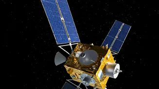
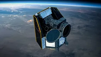
On September 4, 2026, the Indian Space Research Organisation (ISRO) is scheduled to launch EOS-05 aboard its powerful GSLV-F17 rocket from Sriharikota. But this is no ordinary satellite. Also known as GISAT-1A, EOS-05 is India's first imaging satellite designed
to operate from a geostationary orbit, approximately 36,000 kilometres above the Earth. Unlike satellites in lower orbits that pass over a location periodically, a geostationary satellite remains fixed over the same spot. This unique positioning will allow EOS-05 to provide a continuous, near-real-time watch over the Indian subcontinent, a game-changer for tracking rapidly developing events.
The Power of Constant Observation
The primary advantage of EOS-05 is its persistence. The satellite is engineered to capture images of the entire Indian landmass every 30 minutes. For high-priority areas, such as a brewing cyclonic storm or a spreading forest fire, it can revisit and image the location every five minutes. This rapid refresh rate is a monumental leap forward. Current systems provide valuable snapshots, but EOS-05 will offer something closer to a live video feed, enabling authorities to monitor the evolution of a disaster as it unfolds. This capability is crucial for making timely decisions during fast-moving crises like flash floods and cyclones, where every minute counts.
Strengthening the Entire Disaster Cycle
Effective disaster management involves three key phases: preparedness, response, and recovery. India's constellation of Earth observation satellites already plays a vital role in all three, and EOS-05 will significantly enhance these capabilities. Before a disaster, satellite data helps create detailed hazard maps, identifying regions vulnerable to landslides or flooding. During a crisis, near-real-time imagery from EOS-05 will provide unparalleled situational awareness, helping agencies like the National Disaster Management Authority (NDMA) to coordinate rescue operations, plan evacuation routes, and deploy resources to the most affected areas. After the event, the satellite's data will be invaluable for conducting swift and accurate damage assessments, which is critical for guiding relief and reconstruction efforts.
Building on a Legacy of Success
EOS-05 joins one of the world's largest constellations of remote sensing satellites operated by ISRO. This network, including the Cartosat, Resourcesat, and INSAT series, has already proven its worth many times over. For instance, during Cyclone Fani in 2019, data from ISRO's meteorological satellites was instrumental in accurately predicting the storm's path and intensity, leading to the successful evacuation of over a million people. The new satellite is a successor to the GISAT-1 mission, which was unfortunately lost in a launch failure in 2021. The upcoming launch of EOS-05 therefore carries strategic importance, marking a renewed effort to secure this advanced observational capability for the nation.
Beyond Disasters: A Multi-Purpose Sentinel
While its primary role is to bolster disaster monitoring, the applications of EOS-05 extend much further. Its multi-spectral and hyper-spectral cameras can provide crucial data for a wide range of fields. This includes monitoring agricultural health, tracking forest cover, observing changes in coastal zones, and managing water resources. The satellite will also enhance security and strategic observation, providing a high-level overview of the region. This mission is part of a broader vision where space technology becomes an integral tool for governance, economic growth, and improving the lives of citizens across the country.