






India's Eyes in the Sky
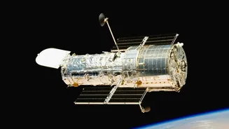
The backbone of India's disaster management is a fleet of advanced Earth observation satellites operated by the Indian Space Research Organisation (ISRO). This includes several key series, each with a specific job. The INSAT (Indian National Satellite
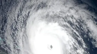
System) series, including INSAT-3D and 3DR, acts as the primary weather watcher, tracking cloud formations, wind patterns, and the genesis of cyclones in real-time. Then there are the radar imaging satellites like the RISAT (Radar Imaging Satellite) series, which have the crucial ability to see through clouds and darkness, making them invaluable for mapping flood inundation during heavy monsoons. Other satellites like the Oceansat series monitor the oceans, providing data on sea surface temperatures that are critical for predicting cyclone intensity.
From Data to Actionable Warning
Capturing images from space is just the first step. The real magic happens when this raw data is transformed into a life-saving forecast. ISRO’s centres, like the National Remote Sensing Centre (NRSC) in Hyderabad, process enormous volumes of data from these satellites. This processed information is then fed to the India Meteorological Department (IMD). The IMD uses this data as a critical input for its advanced weather models to predict the path and intensity of cyclones, or the likely extent of flooding. This seamless collaboration ensures that data doesn't just remain in a lab; it becomes an actionable warning passed on to the National Disaster Management Authority (NDMA) and State Disaster Management Authorities.
Tackling a Spectrum of Disasters
The application of this technology extends across the wide range of natural calamities that India faces. For cyclones, satellites provide early detection and track prediction, which has drastically reduced casualties. In the case of floods, near real-time satellite imagery helps authorities create inundation maps, identify affected villages, and plan rescue and relief operations with precision. For droughts, satellites assess vegetation health and soil moisture over large areas, providing crucial data for agricultural planning. The system is also used to detect and monitor forest fires, helping to contain their spread, and to study geological changes for landslide risk assessment in hilly regions.
The Proof: From Tragedy to Triumph
The impact of this technological leap is most evident in India's management of cyclones. The 1999 Odisha Super Cyclone resulted in over 10,000 fatalities, a tragedy that highlighted the urgent need for better warning systems. Fast forward to recent years, and the story is vastly different. Thanks to precise, satellite-driven forecasts from IMD, authorities have been able to conduct mass evacuations ahead of powerful cyclones like Fani, Amphan, and Yaas, saving tens of thousands of lives. While property damage remains a challenge, the ability to protect human life has been a monumental success, transforming India from a reactive nation to a proactive one in disaster preparedness.
A Direct Line to Citizens
The final, critical link in the chain is ensuring these warnings reach the public. ISRO provides data through public-facing portals like Bhuvan and MOSDAC. More directly, the NDMA, in collaboration with the Department of Telecommunications, has rolled out a cell broadcast system named SACHET. This technology allows geo-targeted emergency alerts to be sent directly to mobile phones in an affected area. Unlike a standard SMS, these alerts can override silent modes with a loud tone, ensuring that critical information about an impending disaster reaches people instantly and effectively, completing the journey from a satellite in orbit to a person on the ground.