







Meet India's New Sentinel: EOS-05
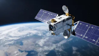
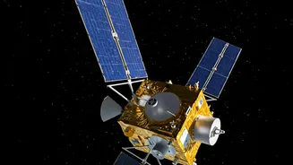
The Indian Space Research Organisation (ISRO) is on the cusp of launching one of its most significant assets, the Earth Observation Satellite, EOS-05. Also known as GISAT-1A, this spacecraft is not just another satellite; it's a state-of-the-art geo-imaging
platform designed for a dual-purpose mission of immense national importance. Planned to be launched aboard a GSLV rocket, EOS-05 is the successor to the GISAT-1 (EOS-03), which was lost in an unsuccessful launch in 2021. This new mission represents a determined push by ISRO to secure a powerful, persistent observation capability from a geostationary orbit. Unlike many other observation satellites, its role is twofold: providing critical data for civilian applications like disaster management while also enhancing the nation's strategic surveillance capabilities. Its launch is a much-anticipated event, marking a new chapter in India's space-based monitoring.
The Geostationary Advantage
The key to EOS-05's power lies in its orbit, approximately 36,000 kilometres above the equator. This is a geostationary orbit, meaning the satellite's orbital period matches the Earth's rotation. To an observer on the ground, the satellite appears to hover over a fixed point. Most Earth-imaging satellites operate in Low Earth Orbit (LEO), passing over a location only for brief moments before continuing their journey around the globe, with revisits potentially taking days. EOS-05, however, can stare continuously at the entire Indian subcontinent and the surrounding oceans. This persistent watch is a game-changer. Instead of getting periodic snapshots, ISRO will get a live feed, allowing for the constant tracking of evolving situations, from weather patterns to movements on the ground.
Tracking Nature's Fury in Real Time
One of the satellite's primary missions is to monitor rapid atmospheric changes. With its advanced imaging instruments, EOS-05 can provide near-real-time imagery of the entire country every 30 minutes, and for select areas of interest, this can be as frequent as every five minutes. This capability is invaluable for tracking fast-developing weather events. Agencies will be able to monitor the formation and progress of cyclones, track the movement of monsoon clouds, and get timely updates on floods and forest fires. This continuous stream of data will significantly improve the accuracy of weather forecasts and the effectiveness of early warning systems, ultimately helping to save lives and minimise damage during natural disasters. The satellite's ability to capture images in multiple spectral bands allows it to see through clouds to some extent and gather a wealth of environmental data.
A Watchful Eye on the Borders
The same continuous monitoring that aids disaster management also provides a significant strategic advantage. EOS-05 is explicitly designed for dual civilian and military use. Its ability to maintain a constant vigil over the Indian subcontinent makes it a powerful tool for national security. Often referred to as India's 'eye in the sky', the satellite can be tasked to provide oversight of remote border regions and areas of strategic interest. While the 42-metre resolution of its camera may not capture the finest details like some LEO spy satellites, its strength lies in persistence. It can detect patterns, track large-scale movements, and monitor changes over time in a way that periodic satellite passes cannot. This persistent surveillance is a critical asset for monitoring border activity, securing strategic assets, and enhancing overall situational awareness for defence forces.