








The Bay of Bengal's Rain Engine
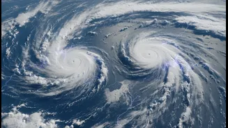
The primary force behind the monsoon's dramatic revival is a well-marked low-pressure area that formed over the Bay of Bengal in early July. Think of a low-pressure system as a giant atmospheric engine. It draws in vast amounts of moisture from the warm
sea, rises, cools, and condenses into thick rain clouds. This particular system was powerful enough to kickstart the active phase of the monsoon after a sluggish start. Initially forming off the coast, it moved west-northwestwards across central India, pulling a river of moisture with it and dumping heavy to extremely heavy rainfall over states like Odisha, Chhattisgarh, and Madhya Pradesh, turning rainfall deficits into surpluses within a week.
The West Coast's Moisture Superhighway
The second key player is a combination of systems working along India's west coast. Meteorologists point to a strong offshore trough—an elongated area of low pressure running from the Gujarat coast down to Karnataka. This trough acts like a conveyor belt, pulling huge volumes of moisture from the Arabian Sea onto the land. Simultaneously, a cyclonic circulation was observed over Maharashtra. This combination is why the west coast, particularly the Konkan region including Mumbai, has been battered by relentless, heavy downpours. Mahabaleshwar, for instance, recorded exceptionally high rainfall, showcasing the sheer power of this western arm of the monsoon.
A Powerful Combination
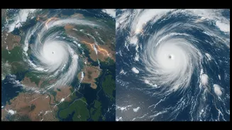
These two systems are not acting in isolation. Their interaction is what creates the widespread and intense monsoon spell felt across the country. The low-pressure system from the Bay of Bengal moving across central India energises the entire monsoon trough—the massive low-pressure belt that stretches across the country. This, in turn, strengthens the westerly monsoon winds blowing in from the Arabian Sea. With both the Bay of Bengal and the Arabian Sea actively feeding moisture into the subcontinent simultaneously, the result is a nationwide spell of heavy rain. In some cases, a third element, a Western Disturbance moving in from the northwest, has further amplified the rainfall, as seen in the intense showers over Delhi and surrounding areas.
From Deficit to Deluge
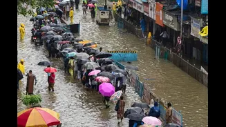
The on-ground impact of this atmospheric pincer movement has been dramatic. After one of the driest June periods in recent memory, the first week of July saw a rainfall surplus of over 40%. Cities like Mumbai and Delhi have experienced significant waterlogging and traffic disruption. The India Meteorological Department (IMD) has issued numerous orange and red alerts for various regions, warning of extremely heavy rainfall, flooding, and potential landslides in hilly areas. While the rain has brought much-needed relief for agriculture and helped fill reservoirs, its intensity has also disrupted daily life and put emergency services on high alert across many states.