


Seeing the Unseen With SAR
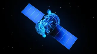
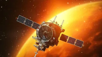
Think of satellite images, and you probably picture clear, sunlit photos of the Earth. But what happens when it’s cloudy, dark, or raining? That’s where Synthetic Aperture Radar, or SAR, comes in. Unlike optical satellites that need light, SAR is an active
remote sensing technology. It sends its own microwave pulses towards the Earth's surface and analyses the returning signals to create an image. This allows it to 'see' through clouds, smoke, and total darkness, providing invaluable data 24/7, regardless of weather conditions. This all-weather, day-and-night capability makes it a game-changer for continuous monitoring.
The Data Deluge and the Skill Gap
India is a major player in this domain. With its own series of advanced RISAT (Radar Imaging Satellite) missions and the landmark NISAR (NASA-ISRO SAR) mission launched in partnership with NASA, the volume of high-quality SAR data is exploding. But raw SAR data looks like TV static to the untrained eye; it requires significant processing to be turned into a goldmine of information. This has created a critical need for professionals who can interpret this complex data and extract actionable insights. This is not just about looking at pictures; it's about running algorithms, understanding signal processing, and turning complex datasets into clear intelligence, creating a major skill gap in the market.
ISRO's Mission to Train the Experts
Recognising this need, the Indian Space Research Organisation (ISRO) is actively building a national talent pool. Through its premier training centre, the Indian Institute of Remote Sensing (IIRS) in Dehradun, ISRO offers a range of courses on remote sensing and geo-informatics. These include free online courses and in-person workshops specifically focused on SAR data processing and its applications. These programmes are designed for students, academics, and working professionals, teaching them the fundamentals of SAR, how to process data from satellites like RISAT, and how to apply these techniques to real-world problems.
Where Are the Jobs?
Proficiency in SAR image processing opens doors across numerous sectors. Government agencies focused on disaster management, agriculture, urban planning, and defence are major recruiters. During floods or landslides, SAR is used to map affected areas and guide rescue operations. In agriculture, it helps monitor crop health and soil moisture, even during the cloudy monsoon season. Beyond government, a thriving private sector is emerging. Indian space-tech startups like GalaxEye Space are pioneering new applications and actively hiring image processing engineers and analysts with SAR skills. These roles involve developing algorithms and building pipelines to serve clients in industries from insurance to environmental monitoring.
Building a Future-Proof Career
The demand for SAR expertise is not just a passing trend. As more advanced satellites are launched, the need for skilled analysts who can manage and interpret this data will only grow. The required skills often include a background in engineering or physics, along with proficiency in programming languages like Python or MATLAB. Job listings for SAR analysts and engineers often seek candidates with a strong understanding of signal processing and algorithm development. For graduates and professionals looking to upskill, mastering SAR processing is a direct path to a high-demand, future-proof career at the intersection of space technology, data science, and environmental stewardship.