



ISRO's Orbiting Sentinels
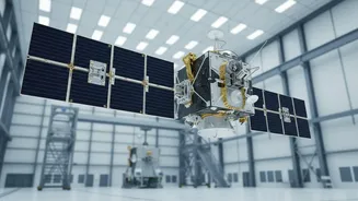
The Indian Space Research Organisation (ISRO) operates a sophisticated fleet of Earth observation satellites that serve as the nation's first line of defence against weather-related disasters. Missions like the INSAT series (including INSAT-3D and 3DR),
the Oceansat series, and SCATSAT-1 continuously monitor the land, atmosphere, and, most importantly for storm surges, the oceans. These satellites are equipped with a variety of advanced sensors, each designed to capture specific data points that, when pieced together, form a comprehensive picture of an approaching storm. They provide synoptic observations at regular intervals, which is critical for tracking the rapid evolution of cyclones forming over the Bay of Bengal and the Arabian Sea.
The Key Sensors and Their Data
Several types of sensors are crucial for storm surge forecasting. Scatterometers, like the one on SCATSAT-1 and the Oceansat series, are particularly vital. These active microwave instruments send radar pulses to the ocean surface and measure the backscatter. The roughness of the sea surface, which is directly related to wind speed and direction, affects this signal. This allows forecasters to get accurate wind vector data even under cloudy conditions, which is essential for understanding a cyclone's strength. Alongside scatterometers, satellite altimeters measure sea surface height, helping to detect the abnormal rise in sea level that defines a storm surge. Other instruments, called radiometers, measure sea surface temperature; warmer waters provide the fuel for cyclones to intensify. The INSAT satellites provide quantitative data on cloud movement, precipitation, and more, adding further layers to the forecast.
From Raw Data to Actionable Warnings
The raw data beamed down from ISRO's satellites is a stream of numbers and signals. It is the job of agencies like the Indian National Centre for Ocean Information Services (INCOIS) and the India Meteorological Department (IMD) to translate this into life-saving warnings. INCOIS uses the satellite inputs on wind speed, wave height, and atmospheric pressure to run sophisticated computer models, such as the ADCIRC model, to simulate how a cyclone will affect the sea level along the coast. This results in the Storm Surge Early Warning System (SSEWS), which can predict the location, time, and height of a potential storm surge with increasing accuracy. These detailed forecasts, often issued in joint bulletins by INCOIS and IMD, are then disseminated to disaster management authorities.
Empowering Action on the Ground
Once a storm surge warning is issued, it sets in motion a well-rehearsed series of actions in coastal cities and districts. The specific, location-based predictions from INCOIS allow officials to make critical decisions. They can identify precisely which low-lying villages are most at risk and need to be evacuated. This targeted approach is far more effective than general warnings and ensures resources are used efficiently. Disaster response teams are mobilised, shelters are prepared, and public announcements are made through various channels, including SMS and mobile apps. The near real-time inundation maps and track predictions provided by ISRO's data enable authorities to plan evacuation routes, reinforce coastal infrastructure, and position relief supplies before the storm makes landfall, significantly reducing the potential for loss of life and property.
The Future of Forecasting
The system is constantly evolving. Newer satellites like Oceansat-3 (EOS-06), launched in late 2022, carry even more advanced sensors, including an improved scatterometer (SCAT-3) and an Ocean Colour Monitor (OCM-3), which enhance the quality and frequency of the data collected. The collaboration on the NISAR (NASA-ISRO Synthetic Aperture Radar) satellite promises to bring in high-resolution data that can further refine our understanding of coastal changes and disaster impacts. As these technological capabilities grow, and as models become more powerful with the integration of AI, the precision of storm surge forecasts will continue to improve. This ensures that India's coastal cities will be even better prepared to face the challenges of an increasingly variable climate, protected by their silent sentinels in space.