







The Mission At A Glance
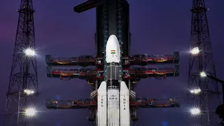
All eyes are on the Satish Dhawan Space Centre in Sriharikota as ISRO finalises preparations for its GSLV-F17 mission. The primary goal of this flight is to deliver the Earth Observation Satellite-05 (EOS-05) into a precise orbit high above our planet.
This isn't just another routine launch; EOS-05 is a state-of-the-art satellite designed to provide a constant, unblinking watch over the Indian subcontinent. Its objective is to provide high-tech weather intelligence, which translates to more accurate and timely information about everything from developing cyclones to the onset of the monsoon. The mission represents a significant step forward in India's ability to monitor its own climate and environment from space, joining a select group of nations with this capability.
The Workhorse: GSLV-F17
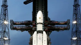
The rocket tasked with this crucial delivery is the Geosynchronous Satellite Launch Vehicle Mark II (GSLV Mk II), designated GSLV-F17 for this flight. Over the years, the GSLV has evolved into one of ISRO's most reliable launchers, especially for placing heavy satellites into geostationary orbit. These are orbits where a satellite moves in sync with the Earth's rotation, appearing to stay fixed over one spot. Early in its history, the GSLV programme faced several challenges, particularly with its complex cryogenic upper stage, which uses super-cooled liquid propellants. However, after mastering this technology indigenously, the vehicle has had a string of successes, transforming it into a powerful and trusted asset for India's space ambitions. For this mission, the 51.7-metre-tall rocket will hoist the 2,367 kg EOS-05 satellite, first placing it into a Sub-Geosynchronous Transfer Orbit before the satellite uses its own power to reach its final destination.
An Eye In The Sky: The EOS-05 Satellite
The star of the show is the EOS-05 satellite, a highly advanced Earth observation spacecraft. What makes EOS-05 special is its intended orbit and purpose. It is India's first imaging satellite designed to operate from a geosynchronous orbit, approximately 36,000 km above Earth. While other Indian satellites in Low Earth Orbit provide valuable data, they pass over a given area only periodically. EOS-05, by contrast, will maintain a constant watch over the Indian landmass. This allows it to capture imagery of the entire country roughly every 30 minutes, and of specific regions of interest as frequently as every five minutes. Equipped with multispectral and hyperspectral imaging payloads, it can see in different wavelengths of light, providing rich data that goes far beyond a simple picture. This constant monitoring is crucial for tracking rapidly developing events like storms and floods.
From Space To Your Screen: Real-World Impact
The technology aboard EOS-05 will have tangible benefits for every Indian. The primary application is in significantly improving weather forecasting. By providing continuous, near real-time data on cloud formation, cyclones, and other weather phenomena, it will give meteorologists the tools to make more accurate and timely predictions. This translates directly to better disaster management, as authorities will get earlier warnings for cyclones, floods, and forest fires, allowing for more effective evacuations and response efforts. Beyond disasters, the satellite's data will support a wide range of sectors. Agriculture will benefit from better monitoring of crop health and soil conditions. Urban planners will have a new tool for managing resources, and scientists will gain invaluable data for studying climate change. The mission will also enhance surveillance capabilities for national security.