




The Myth of the Single Forecast
It’s a common scenario for travellers from Mumbai, Delhi, or Bengaluru. You check the forecast, which predicts light showers, and head out for your weekend escape. But just a hundred kilometres away in the hills of Lonavala or the valleys of Himachal,
you might find yourself facing torrential downpours and blocked roads. The reason is simple: India's diverse geography makes weather intensely localised. A city forecast is influenced by urban factors like the 'heat island effect', and often fails to capture the complex weather patterns of nearby mountains or coastal areas. India's tropical climate and varied terrain, from the Western Ghats to the Himalayas, create countless microclimates where conditions can change dramatically within a few kilometres.
Understanding Microclimates and Topography
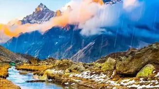
A microclimate is a small area with a climate that's different from the region around it. Mountain ranges are a prime example of this phenomenon. The Western Ghats, for instance, act as a massive barrier to moisture-laden winds from the Arabian Sea. The windward side receives extremely heavy rainfall, resulting in lush, dense forests. The leeward side, just across the peaks, remains much drier in what is known as a rain-shadow effect. This is why a forecast for Pune is a poor indicator for the ghat sections leading to it. Elevation, valleys, and forest cover all create unique weather conditions that a city-based prediction cannot account for, making it essential to think smaller and more local.
Your Pre-Travel Local Checklist
Before you even pack your bags, shift your focus from the general to the specific. Instead of just a city forecast, look for district-level or even block-level weather warnings. The India Meteorological Department (IMD) provides detailed, colour-coded warnings for districts across the country. These alerts (green, yellow, orange, red) give a much clearer picture of expected rainfall intensity in your specific destination. Beyond the forecast, check the status of the exact roads and highways you plan to take. Heavy rains can trigger landslides, cause waterlogging, or lead to the closure of bridges with little warning. A beautiful drive can quickly become a stranded nightmare.
Real-Time Information is Your Best Friend
Once your trip is underway, real-time updates are crucial. Local authorities and police departments often post updates about road closures and diversions on social media. Navigation apps like Google Maps and Mappls allow users to report hazards like waterlogging, accidents, or landslides, creating a live picture of road conditions for other travellers. Before making the final leg of your journey into a remote area or up a ghat, it’s always wise to call your hotel or a local contact. They can provide the most accurate, on-the-ground information about accessibility and safety, which no weather app can fully replicate.
Embracing the Monsoon, Safely
The goal isn't to discourage monsoon travel, but to encourage smarter, safer travel. The beauty of the season is best enjoyed with preparedness. This means packing waterproof gear, keeping your itinerary flexible, and having buffer days to account for potential delays. Understanding that local conditions are king allows you to plan around the rain, not against it. By respecting nature's unpredictability and prioritizing hyper-local information, you can ensure your weekend getaway is memorable for its misty landscapes and not for getting stuck in a landslide.