


A Welcome Break from the Heatwave
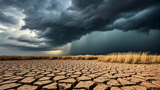
For several days, residents across Uttar Pradesh have been grappling with a severe heatwave. Cities like Prayagraj recently recorded highs of 43°C, making it one of the hottest places in the state. The India Meteorological Department (IMD) had issued
heatwave alerts for numerous districts, advising caution as the scorching temperatures and high humidity made daily life a struggle. This intense heat is part of a broader pattern that has affected much of North India, with many cities in UP consistently featuring on the list of the country's hottest locations. The arrival of these pre-monsoon showers is therefore not just a change in weather, but a significant and eagerly awaited respite.
The Science of the Easterly Winds
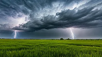
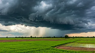
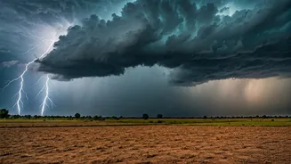
So, what exactly is causing this sudden change? The answer lies in the winds. Typically, the main southwest monsoon arrives with winds from the Arabian Sea. However, the current spell of rain is being driven by easterly winds. These winds travel from the Bay of Bengal, picking up a significant amount of moisture along the way. As this moist air moves over the heated landmass of Uttar Pradesh, it creates atmospheric instability. The warm, moist air near the surface rises, and as it reaches cooler altitudes, the moisture condenses to form thunderclouds, resulting in localized but intense showers and thunderstorms. This phenomenon is a classic precursor to the main monsoon season in the region.
Impact on the Ground
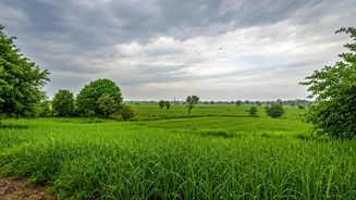
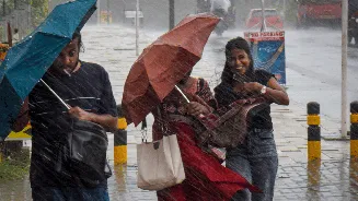
The impact of these thundershowers is being felt across various parts of East UP, particularly in and around districts like Gorakhpur, Varanasi, Ballia, and Prayagraj. The most immediate effect is the noticeable drop in temperature, providing relief from the oppressive heat. For farmers, these pre-monsoon showers are critical. They provide the necessary moisture to prepare the fields for the upcoming Kharif sowing season. However, the storms can also bring challenges. The IMD has warned of gusty winds accompanying the rain, which can reach speeds of 40-50 kmph, and has advised residents to be cautious and avoid taking shelter under weak structures during thunderstorms.
What to Expect Next
While these showers are a welcome sign, they are just the opening act for the main event: the Southwest Monsoon. According to the IMD, conditions are becoming favorable for the monsoon to advance further into Uttar Pradesh over the next few days. The Northern Limit of Monsoon, which has been stalled over Bihar, is expected to push into the eastern districts of UP soon. The IMD forecasts that rainfall activity will likely increase significantly from the end of June into early July, with fairly widespread rain expected across East UP between July 1st and 3rd. This indicates that while the current relief is from localized thundershowers, the more sustained, widespread rainfall of the monsoon is just around the corner, promising a definitive end to the season's heatwave.