




The Monsoon's Allure and Dangers
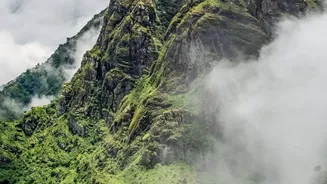
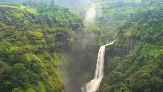
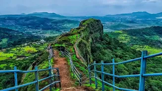
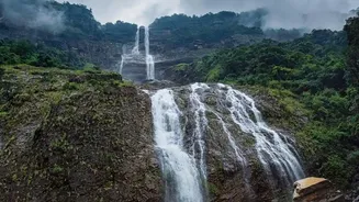
Every year, as the monsoon clouds gather over India’s southwestern coast, the Western Ghats transform into a vibrant green paradise. Waterfalls cascade down ancient cliffs, mist hangs heavy in the valleys, and the landscape comes alive with a unique seasonal
energy. For trekkers, this is a magical time to explore. However, the same rains that bring the region to life also introduce significant dangers. Trails become slick and treacherous, especially on the lateritic and basaltic rock common to the area. Continuous downpours can cause flash floods in narrow gullies and swell streams, making crossings hazardous. Add to this the challenge of dense fog that can reduce visibility to mere metres, and it’s clear why monsoon trekking requires careful planning and expert guidance.
Plotting a Safer Path with GPS
In response to these challenges, a growing number of adventure tourism companies are integrating Global Positioning System (GPS) technology into their planning and operations. This isn't just about handing a guide a GPS device; it's a sophisticated, data-led approach to route design. Before the season even begins, operators use GPS mapping software combined with topographical data and satellite imagery to analyse potential trails. This allows them to identify and flag high-risk sections, such as steep slopes prone to slipperiness, areas with a history of landslides, or riverbeds that could become dangerous torrents after heavy rain. By plotting routes digitally, companies can create safer itineraries that actively avoid these known hazards, offering a more reliable experience for clients.
How Digital Route-Planning Works
The process starts with a digital map. Planners can download detailed maps for offline use, crucial for remote areas with no mobile network. They then overlay historical weather data and recent satellite images to assess the current state of the terrain. A route that was safe last season might be compromised by erosion or a new obstruction. The GPS software allows them to plot waypoints, measure distances accurately, and analyse the elevation profile of a trail. This helps in creating treks that are not only safer but also better matched to a client’s fitness level. On the trail itself, guides use handheld GPS devices or specialized smartphone apps to follow the pre-planned route precisely, ensuring the group stays on the safest path even in low-visibility conditions. These devices also record the actual track, which can be followed back in case of disorientation.
Technology and Tradition: A Powerful Combination
While GPS technology provides a powerful safety net, reputable companies emphasize that it is a tool to augment, not replace, the invaluable knowledge of local guides. An experienced guide can read the environment in ways a satellite cannot. They can hear the sound of a distant, swelling stream, spot fresh animal tracks, or interpret the behaviour of clouds to anticipate a sudden downpour. The most effective safety strategy combines the macro-level planning of GPS with the micro-level, real-time awareness of a seasoned guide. This blend of modern tech and traditional wisdom ensures that trekking groups are prepared for both predictable risks and sudden, unforeseen challenges.
What This Means for Trekkers
For anyone looking to experience the monsoon magic of the Western Ghats, this technological shift brings significant benefits. Firstly, it offers greater peace of mind. Knowing your trail has been vetted for monsoon-specific risks allows you to focus more on the experience. Secondly, it enhances safety. In an emergency, a GPS device can provide precise location coordinates to rescue teams, dramatically reducing response times. Many devices also feature SOS buttons that can send a distress signal via satellite, even without mobile service. Finally, it opens up the region to more people. By creating reliably safe routes, companies can more confidently guide beginner and intermediate trekkers who might otherwise be hesitant to venture out during the rainy season. This responsible adoption of technology is making one of India's most stunning landscapes more accessible and safer for all.