




The Invisible Threat Becomes Visible
Methane is the primary component of natural gas and a potent greenhouse gas, over 80 times more powerful than carbon dioxide at trapping heat in the short term. For years, tracking its release into the atmosphere was a significant challenge, relying on calculations
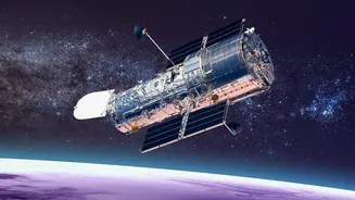
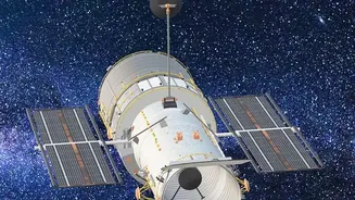
and infrequent on-the-ground inspections. This system left massive data gaps, especially for intermittent 'super-emitter' events, which can account for up to 50% of the industry's total emissions. Today, a new generation of specialized satellites is making this invisible threat visible. Orbiting hundreds of kilometers above Earth, these instruments can detect methane's unique signature in reflected sunlight, pinpointing plumes with unprecedented precision. This technology transforms methane monitoring from an exercise in estimation to a process of direct observation.
How Satellite Intelligence Works
The technology at the heart of this revolution is advanced spectroscopy. Satellites like those operated by GHGSat, or nonprofit-led missions such as MethaneSAT, are equipped with sensors that measure how methane absorbs light at specific infrared wavelengths. By analyzing this light absorption, scientists can not only identify a methane plume but also quantify its size and flow rate. Some systems, like Europe's Sentinel-5P, provide wide-area maps to identify regional hotspots, while others offer high-resolution imagery capable of attributing a leak to a specific facility, pipeline, or even a single piece of equipment. This tiered approach, combining broad scans with targeted analysis, creates a comprehensive picture of emissions that was previously impossible to achieve, turning satellite data into actionable intelligence.
From Data to Action
This newfound transparency is creating a powerful new benchmark for corporate and regulatory accountability. The data, often made publicly available, is used by environmental groups, investors, and governments to verify corporate claims and enforce regulations. For example, the U.S. Environmental Protection Agency has a program that allows certified third parties to report super-emitters detected via satellites, compelling operators to investigate and repair leaks. For natural gas companies, this intelligence presents both a risk and an opportunity. Publicly identified leaks can lead to regulatory penalties and damage a company's reputation. However, the data also enables operators to find and fix leaks faster, preventing the loss of a valuable product and improving operational efficiency. Some companies are already integrating this satellite data into their leak detection and repair (LDAR) programs to act more quickly.
The Future of Energy Transparency
The era of estimating emissions is rapidly coming to an end. Early data from missions like MethaneSAT has already revealed that methane emissions from global oil and gas operations are significantly higher than official inventories suggest. This reality check is forcing a reckoning within the industry. As satellite technology becomes more sophisticated and the data more widespread, it will become increasingly difficult for companies to hide their environmental performance. Investors are already using methane data as a key metric for valuing assets, and nations are considering it for import regulations. This shift doesn't just apply to oil and gas; the technology holds promise for monitoring other major methane sources like agriculture and landfills. The message is clear: if you are releasing methane into the atmosphere, the world is now able to watch.