



What is the EOS-05 Satellite?
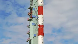
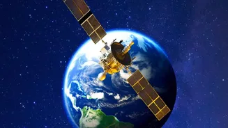
EOS-05, also known as GISAT-1A, is an advanced Earth observation satellite developed by the Indian Space Research Organisation (ISRO). Unlike many other observation satellites that orbit the Earth multiple times a day from a lower altitude, EOS-05 is positioned
in a geostationary orbit approximately 36,000 kilometres above the equator. This unique position allows it to remain in a fixed spot relative to the Earth's surface, enabling continuous observation of the Indian subcontinent and surrounding oceans. This constant watch is a significant upgrade, providing near real-time imagery that is crucial for tracking rapidly developing events. The mission, launched on September 4, 2026, marks a critical step forward after a previous attempt to launch a similar satellite, EOS-03, was unsuccessful in 2021.
A Game-Changer for Disaster Management
One of the most significant applications of EOS-05 is in the field of disaster management. India's long coastline and diverse geography make it vulnerable to a range of natural calamities, including cyclones, floods, and forest fires. The satellite's ability to provide frequent images—capturing the entire Indian landmass roughly every 30 minutes and specific areas of interest as often as every five minutes—is a paradigm shift for disaster response agencies. For cyclone monitoring, this near real-time data allows meteorologists to track a storm's development, predict its path with greater accuracy, and issue timely warnings for evacuation. This capability is crucial for saving lives and minimising property damage along coastal regions. Similarly, for events like large-scale forest fires or flash floods, the satellite can help authorities monitor the situation as it unfolds and deploy resources more effectively.
Advanced Instruments for Detailed Insights
The power of EOS-05 lies in its sophisticated imaging instruments. The satellite is equipped with multispectral and hyperspectral cameras that can see the Earth in various wavelengths of light, far beyond what the human eye can perceive. These instruments allow it to gather a wide range of data. For instance, it can monitor changes in vegetation, track the health of crops, and observe changes in land use over time. This information is invaluable for agricultural planning, environmental monitoring, and managing natural resources. By analysing spectral signatures, scientists can assess forest cover, monitor water bodies, and even gain insights into mineralogy. This constant stream of detailed data supports not only immediate disaster response but also long-term climate resilience and strategic planning.
Strengthening India's Strategic Capabilities
Beyond its civilian applications in weather and disaster management, EOS-05 also enhances India's strategic observation capabilities. A satellite that can provide persistent surveillance over a large geographic area has inherent security benefits. While its primary mission is focused on environmental and disaster monitoring, the ability to observe the Indian subcontinent and its maritime neighbourhood continuously strengthens national security. This persistent monitoring from a geostationary orbit provides a strategic advantage that satellites in lower orbits, which pass over a location only at specific times, cannot offer. The successful operation of EOS-05 solidifies India's position among a select group of nations with advanced geo-imaging satellite technology, bolstering its self-reliance in space-based observation.