








Decoding GRITSS: More Than Just an Acronym
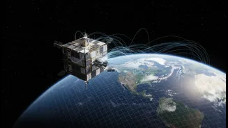
GRITSS stands for Geodetic Reference Instrument Transponder for Small Satellites. It’s a technology demonstration mission from NASA that successfully launched on July 7, 2026. At its core, GRITSS is designed to solve a very old and very difficult problem:
how to measure our planet with extreme precision. The Earth is not a perfect, static sphere. It breathes and shifts, with continents moving, ice sheets melting, and sea levels rising. To track these changes, scientists rely on a global standard called the International Terrestrial Reference Frame (ITRF), which is essentially the most precise map of the Earth that we have. GRITSS’s job is to make this foundational map, and by extension all data that relies on it, vastly more accurate—down to the millimetre.
The Millimetre Challenge: Fixing a Measurement Mismatch
Currently, the ITRF is built by combining data from three separate, powerful technologies. The first is the Global Navigation Satellite System (GNSS), which includes the GPS your phone uses. The second is Very Long Baseline Interferometry (VLBI), which uses giant radio telescopes to observe distant cosmic objects. The third is Satellite Laser Ranging (SLR), where ground stations shoot lasers at satellites and measure the reflection time. The problem is that combining data from these different systems introduces tiny errors, on the scale of millimetres, because their reference points on the ground are not perfectly aligned. GRITSS solves this by acting as a single, unified target in space. By having all three systems track the GRITSS satellite simultaneously, scientists can finally sync them up perfectly, eliminating those nagging errors and creating a single, ultra-stable reference point.
From Space to Your Screen: The Future of Navigation
While you will never directly interact with GRITSS, its impact will trickle down to the technology you use every day. A more accurate global reference frame means that all satellite navigation systems built upon it become more precise. This includes GPS, Russia's GLONASS, Europe's Galileo, and importantly for India, our own NavIC system. Over time, this enhanced accuracy could lead to more reliable location services on your smartphone, safer and more efficient routes for self-driving cars, and more precise flight paths for aircraft. It’s the foundational upgrade that makes all subsequent mapping and navigation applications better, stronger, and more trustworthy. The improvements won't happen overnight, but GRITSS is laying the groundwork for a new generation of location-aware technology.
A New Lens on Climate Change
Perhaps the most critical application of GRITSS is in climate science. Many of the most important indicators of a changing climate—such as rising sea levels, melting glaciers, and shifting groundwater reserves—involve changes of just a few millimetres per year. If your measurement tools have a margin of error that is as large as the change you are trying to detect, your data becomes unreliable. By improving the accuracy of the ITRF to the sub-centimetre level, GRITSS will give scientists a much clearer and more confident picture of what is happening to our planet. This allows for more accurate models of sea-level rise affecting coastal cities, better monitoring of droughts and water resources, and a deeper understanding of phenomena like the El Niño cycle. In a world grappling with climate change, this level of precision is not a luxury; it's a necessity.
Why GRITSS Matters for India
The practical choice for India lies in understanding how this global advancement supports our own strategic goals. India has invested heavily in its own space and navigation infrastructure, most notably with the GAGAN (GPS Aided GEO Augmented Navigation) system, co-developed by ISRO and the Airports Authority of India. GAGAN already enhances GPS accuracy for civil aviation, making landings safer and air travel more efficient across Indian airspace. A more precise global reference frame from GRITSS provides a better foundation for systems like GAGAN and NavIC to build upon. This means potentially even more accurate monsoon forecasts, better management of our agricultural and water resources, more effective planning for urban infrastructure, and improved disaster management capabilities during cyclones and floods. GRITSS elevates the entire global system, and as a major space-faring nation, India stands to benefit significantly from this higher tide of precision data.