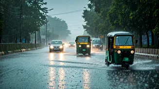


From Drizzle to Gridlock in Minutes
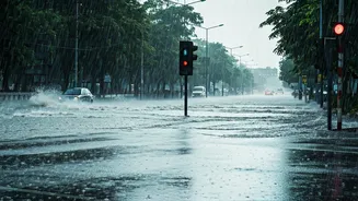
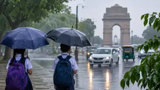
Every Delhi-NCR resident knows the scene. One moment, it's a normal commute. The next, the sky opens up, and within half an hour, major arterial roads are submerged, traffic is at a standstill, and a ten-kilometre journey looks set to take three hours.
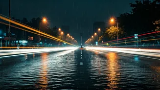
This rapid transformation from functional roads to impassable water channels is a hallmark of the monsoon season. Areas that were clear just minutes before can become waterlogged, leading to vehicle breakdowns, chaotic traffic snarls, and commuters being stranded for hours. The suddenness is the key challenge; a short, intense burst of rain is often enough to bring the Millennium City and the national capital to their knees, turning a routine drive into a test of patience and endurance.
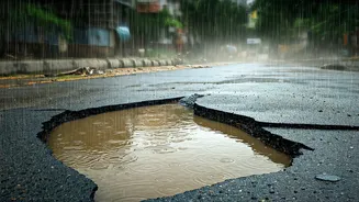
The Science of the Sinking City
So, why does this happen year after year? The answer lies in a combination of factors. Firstly, the region's drainage systems are old and overwhelmed. Many were designed decades ago and simply cannot handle the volume of water from today's high-intensity rainfall, a problem exacerbated by climate change. Secondly, rapid and often unplanned urbanization plays a huge role. The relentless pace of construction has led to widespread concretisation, leaving very little open ground for rainwater to be absorbed. Instead, this massive runoff is channelled into stormwater drains that are often clogged with silt, garbage, and even sewage, preventing water from flowing into the Yamuna. Encroachments on floodplains and natural drainage paths further shrink the space for water to go, ensuring that even moderate rain leads to significant flooding.
Monsoon Hotspots to Avoid
Authorities have identified hundreds of waterlogging hotspots across the region. In Delhi, recurring trouble spots include areas around the Pragati Maidan tunnel, ITO, Minto Bridge, and the Outer Ring Road near the ISBT. Key underpasses like Pul Prahladpur and Zakhira are notoriously vulnerable. In Gurugram, NH-48, Hero Honda Chowk, IFFCO Chowk, and Golf Course Road are known to become gridlocked. Noida is not immune either, with the DND flyway approaches, low-lying roads in Noida Extension, and stretches of NH-9 near the Ghaziabad border flooding predictably. Ahead of the 2026 monsoon, the Delhi government identified 169 such prone locations, mapping them for special monitoring and deploying pumps.
Your Smart Commuting Checklist
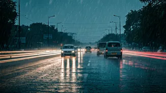
Navigating the NCR during a downpour requires a strategy. First and foremost, check the forecast and traffic before you leave. Use apps like Google Maps for real-time traffic updates. If heavy rain is predicted, consider whether you can work from home or adjust your travel times to avoid the peak chaos. Keep an emergency kit in your car with water, snacks, a phone charger, and a first-aid kit. Ensure your vehicle is monsoon-ready with good tyres, working wipers, and effective brakes. If you get caught in a waterlogged area, it is safer to abandon your vehicle than to risk driving through deep water, which can damage the engine and electronics. The Delhi Traffic Police often issue advisories on social media during heavy rain, which can be a valuable source of information on which routes to avoid.
What Are the Authorities Doing?
In response to the perennial problem, municipal bodies and the Public Works Department (PWD) undertake annual de-silting drives and prepare for the monsoon. For the 2026 season, Delhi's PWD identified 448 waterlogging points based on data from the last three years and assigned specific officers to each location to ensure accountability. Mobile and permanent pumps are deployed at critical locations, and rapid response teams are kept on standby. The Delhi Traffic Police also work to manage diversions and inform the public about congested routes. However, officials often state that the sheer intensity of rainfall in a short period can overwhelm even the best preparations, highlighting the need for a long-term overhaul of the region's drainage infrastructure.