



A New Eye in the Sky
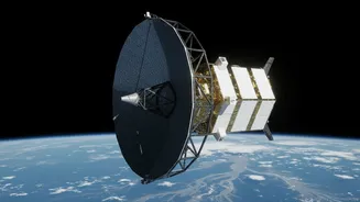
The mission is called NISAR, which stands for NASA-ISRO Synthetic Aperture Radar. Launched on July 30, 2025, this earth-observation satellite is one of the most ambitious and expensive of its kind. It represents a 50-50 partnership between the two space
agencies, with NASA providing the L-band radar and other components, while ISRO contributed the S-band radar, the spacecraft itself, and the powerful GSLV rocket that carried it into orbit from Sriharikota. The goal is to scan nearly the entire planet every 12 days, creating an unprecedentedly detailed and dynamic map of Earth’s surface, from its shifting tectonic plates to its croplands and ice sheets. For India, its value is intensely practical, offering a high-tech tool to manage some of the country's most pressing environmental challenges.
Seeing Through the Storm
What makes NISAR a game-changer is its advanced radar technology. Unlike optical satellites that are blinded by clouds, dust, or darkness, Synthetic Aperture Radar (SAR) can see through these obstacles. This all-weather, day-and-night capability is crucial for a country like India, where monsoon floods are often obscured by heavy cloud cover. NISAR is the first satellite to use two different radar frequencies (L-band and S-band) simultaneously. The L-band radar is particularly effective at penetrating forest canopies and vegetation, while the S-band provides information about the top layer of vegetation and soil moisture. This dual-frequency approach allows scientists to get a much more comprehensive picture of what's happening on the ground, even in densely forested or vegetated areas that were previously difficult to assess during floods.
From Data to Disaster Response
The true power of NISAR lies in its ability to detect tiny changes in the Earth's surface—as small as a centimetre. When it comes to floods, this precision offers several revolutionary benefits. Firstly, the satellite can create detailed maps of inundated areas with a resolution of 5-10 metres, clearly showing the extent of flooding. This includes identifying waterlogged croplands and even areas where forests are flooded, which appear bright in radar imagery due to the way the signal bounces between the tree trunks and the water surface. Secondly, NISAR can act as a 'virtual stream gauge'. By comparing images taken just days apart, it can measure changes in water levels with centimetre-level accuracy, providing crucial information for forecasting how a flood might progress downstream. This data can be delivered to disaster response agencies within hours, enabling much faster and more targeted rescue and relief efforts.
A Leap Forward for Indian Flood Management
For India's disaster management authorities, NISAR's capabilities represent a monumental leap from a reactive to a proactive stance. The frequent, reliable data will help create far more accurate flood inundation models. Instead of relying solely on sparse ground-based river gauges, authorities will have a continuous, wide-area view of how water is moving across entire river basins. This will enhance early-warning systems, giving communities more time to prepare and evacuate. In the aftermath of a flood, the data will be invaluable for damage assessment, helping to quickly identify the worst-hit villages, farms, and infrastructure, thereby streamlining the allocation of resources for recovery and rebuilding. ISRO has already been using satellite data for flood management, but NISAR's advanced capabilities and rapid revisit time will significantly strengthen this capacity.
More Than Just Floods
While its application for flood management is a headline feature, NISAR's purpose extends much further. The same technology that tracks water can also monitor changes in agricultural lands, helping to assess crop health and ensuring food security. It will track the retreat of Himalayan glaciers, measure ground subsidence due to groundwater depletion, and provide early warnings for landslides by detecting subtle ground movement. By observing changes in ecosystems, ice sheets, and the Earth's crust, the mission will provide critical data for understanding the broader impacts of climate change. This single mission will therefore provide a wealth of information to support a wide range of scientific research and public services, benefiting everything from urban planning to environmental protection.