



A Redemption Mission Five Years in the Making
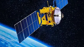
The upcoming launch of GISAT-1A, also known as EOS-05, is one of the most anticipated missions for the Indian Space Research Organisation (ISRO). Scheduled to lift off aboard a GSLV-F17 rocket, this mission carries the weight of a past failure and the promise
of a powerful new capability for the nation. In August 2021, its predecessor, GISAT-1 (also called EOS-03), was lost during launch when the GSLV rocket's cryogenic upper stage failed to ignite. The loss was a significant setback, leaving a critical gap in India's observation capabilities. Now, five years later, GISAT-1A represents not just a replacement, but a redemption, aiming to finally place this vital asset into its designated orbit.
The Power of a Fixed Gaze
What makes the GISAT series so different from other Earth observation satellites? The answer lies in its orbit. Most imaging satellites, like those in the Cartosat series, circle the Earth in a Low Earth Orbit (LEO), passing over a specific location only for a few minutes each day. In contrast, GISAT-1A is designed for a geostationary orbit, approximately 36,000 kilometres above the Earth's surface. At this altitude, the satellite's orbital speed matches the Earth's rotation, making it appear to hover over a fixed point above the Indian subcontinent. This unique vantage point transforms it from a periodic visitor into a constant watchdog, enabling near real-time monitoring of a vast geographical area.
India's Watchtower for Disasters and Security
From its stationary perch, GISAT-1A will provide a continuous stream of high-resolution imagery, a capability with profound implications. Its primary mission is to bolster disaster management. The satellite can track the development and movement of cyclones, monitor the spread of floods and forest fires, and provide rapid assessments of landslide-prone areas. This near real-time data is invaluable for issuing timely warnings and coordinating effective relief efforts. Beyond civilian applications, GISAT-1A serves a strategic purpose. Its ability to provide persistent surveillance over land and sea borders enhances national security and maritime awareness, offering a crucial layer of intelligence. It can monitor infrastructure, track changes in land use, and provide data for agricultural planning, from crop health to water stress.
The Technology Onboard
To achieve its mission, GISAT-1A is equipped with sophisticated imaging instruments. It carries a 700mm Ritchey-Chrétien telescope, a powerful and proven design. The satellite can capture images across multiple spectral bands, including visible, near-infrared, and short-wave infrared. This allows it to see more than the human eye, detecting variations in vegetation health, mineral composition, and surface temperatures. One of its key features is its high temporal resolution—the ability to image a selected area of interest as frequently as every five minutes, and to cover the entire Indian landmass every half-hour with a resolution of about 42 metres. This rapid revisit capability is what truly sets it apart, allowing observers to watch events unfold almost as they happen.