







More Than Just Rocket Science
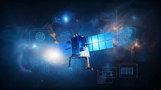
When you hear 'satellite skills,' you might picture engineers in lab coats building spacecraft. While that's part of it, the real boom is in what we do with the information satellites provide. These skills fall into two main categories. The 'upstream'
part involves designing, building, and launching satellites. Startups like Skyroot Aerospace and Agnikul Cosmos are making headlines here. But the bigger revolution is 'downstream'. This is where the magic happens for the rest of us. It involves using satellite data for a vast range of applications on Earth. Key skills now in high demand include satellite data analysis, remote sensing, and Geographic Information Systems (GIS). Professionals in these fields don't build the satellites; they interpret the data they collect to solve real-world problems.
Why the Sudden Buzz?
A perfect storm of policy changes and technological advancements has put satellite skills in the spotlight. In 2020, the Indian government opened up the space sector to private companies, ending decades of near-exclusive control by the Indian Space Research Organisation (ISRO). This move, championed by the Indian National Space Promotion and Authorisation Centre (IN-SPACe), was designed to fuel innovation and private investment. And it worked. The number of space-tech startups has skyrocketed from just one in 2014 to over 400 by 2024. The government has further fuelled this growth by allowing up to 100% foreign direct investment (FDI) in parts of the satellite industry and setting up venture capital funds for startups. As a result, India's space economy, valued at around $8.4 billion, is projected to surge to $44 billion by 2033.
From Farm to Finance: The New Frontier
The impact of these skills is being felt across almost every sector. In agriculture, satellite imagery is transforming farming. Companies now use this data to analyze crop health, monitor soil moisture, and predict yields, enabling 'precision agriculture'. This not only helps farmers increase productivity but also allows financial institutions to make faster, more accurate lending decisions. Banks can now assess a farm's risk and approve loans in minutes instead of weeks, all thanks to satellite data analytics. Beyond the farm, these skills are crucial for urban planning, helping to design smart cities and manage infrastructure projects. They are also vital for disaster management, environmental monitoring, defence, and even in the insurance industry to assess risk. The market for Earth observation and satellite data services is growing at a staggering pace, creating jobs for GIS specialists, data analysts, and remote sensing professionals.
Joining the Constellation of Talent
The explosive growth of the space-tech sector has created a soaring demand for skilled talent. The industry now employs over 45,000 people, and that number is set to climb rapidly. For students and professionals, this translates into a wide array of career paths, including satellite systems engineer, data scientist, remote sensing analyst, and GIS developer. To meet this demand, numerous educational institutions and private training centres are offering specialised courses. ISRO's own Indian Institute of Remote Sensing (IIRS) provides comprehensive training in geospatial technologies. Additionally, many online platforms and universities now offer certificate programmes and degrees in GIS, remote sensing, and scientific computing to equip the next generation with these sought-after skills.